Friday 29 November 2019

Railway Housing in Greater Christchurch [1]: Introduction

As we all know, when NZR developed their network, staffing requirements especially in remote locations often required housing to be provided. There are a number of townships in NZ where the amount of railway staff housing was significant compared to the overall community, including several railway towns - Otira on the Midland Line being one of the best known examples and one of the few that is still substantially unaltered today.

In the course of the Greater Christchurch research several housing settlements have come to light around the city, some of which have long gone and others which still exist in some form, however in general Kiwirail does not have any houses of its own these days and only occasionally leases properties as needed such as at Otira. At a major station there would generally be a stationmaster's house which was separate from most other housing, the latter tending to be a row of houses close together, and generally without driveways or garages although a small shed was commonly seen on the majority of sections.

As we generally know, NZR housing became a major focus around 100 years ago to the extent that a housing factory was built at Frankton (the buildings still exist in some form) and prefabricated standarised designs were churned out for a number of years afterwards. Hence it becomes possible to identify ex-Railway houses by sight in some areas because of the characteristic appearance. Wherever possible, Railway housing settlements were often placed at the edges of railway yards.

We haven't specifically researched Railway housing in the Greater Christchurch area just yet but intend to do so as it is becoming a topic of interest and the map key does include a code for marking houses which has been undertaken on other maps we have developed, most notably the Otago Central line, so having stumbled across a number of files specifically related to housing in our research currently on Lyttelton, we now intend to research the housing more intensively in order to document it as part of the maps.

Our research some weeks ago on Christchurch Station, for example, documented that a house for the stationmaster may have been provided somewhere in the area in the early 20th century, but it was not too long before NZR started to pay their stationmasters allowances to live in their own houses elsewhere. For example, paying the telephone connection and monthly fees for the Christchurch stationmaster was undertaken for many years in recognition that they would be expected to be available on-call most of the time when not actually working.

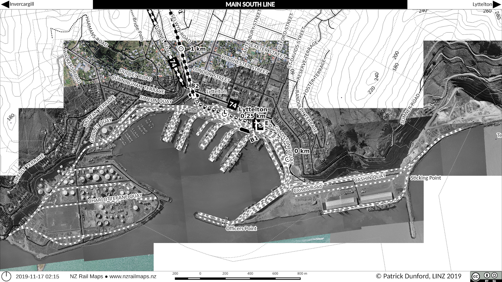
Housing at Lyttelton appears to have been located all over the township rather than being clustered close to the station. So far we have uncovered that NZR owned houses as high up as College Road and Brenchley Road (these locations are near the northmost limits of housing development on the eastern side of the township). As our aerial photos at the moment don't go that high, we may have to extend them if possible in order to show the housing on maps.

Heathcote is an interesting place to investigate as well because a housing development was undertaken c. 1960 at Railway Terrace, between the upper section of Martindales Road, Port Hills Road and the Tunnel Road. At this stage we can only speculate that the intention was to provide for a number of staff housing needs in the general area rather than specifically for Heathcote, as it is evident on the map that there were approximately 20 houses constructed, and Heathcote has never been a major station that would have required a significant number of staff - by that stage probably only a stationmaster and/or signalman. Since NZR sold the housing, some of the sections have been redeveloped but there are still some of the staff houses in place. Further research has yet to be completed on this settlement and the other NZR housing that is known to exist around Heathcote.

Then-new housing development at Heathcote in 1961. Martindales Road has been extended to give access to the tunnel road formation during the construction of the Lyttelton Road Tunnel project.

View of some of the wider area in 1970, including a water reservoir on the hillside above that no longer exists today.

Same view as the first map but taken 2015, the settlement has changed much but some of the houses are essentially the same.

No survey of railway housing in Greater Christchurch would be complete without looking at the settlements around Addington Railway Workshops. At this stage we know little about this housing except that due to the extensive changes in the transport landscape that have taken place in Addington over the past 30 years, even some of the streets these houses were in have disappeared.

The first area that may have been a railway settlement at Addington is directly north of the Shops site in Lowe Street. Earlier aerial photos show this was almost all in housing, whereas today there is hardly anything left due to it becoming mostly commercial and light industrial in nature.

Addington in 1940. The area that may have been a railway housing settlement is bounded by Lowe Street, Tyne Street and what later became Blenheim Road (known as Alliance Street at the time). There already seems to have been some industrial development in Pope Street in the area opposite the saleyards that later became the NZR Publicity and Advertising premises.

 The same area of Addington in 2015, some 75 years later. Tower Junction occupies the Shops site, and the housing has almost completely disappeared from view. In fact there was just one of the old houses in a run down condition which appears to the left and slightly below the 0.5 km peg. But the latest imagery from Canterbury Maps (below) shows it too has gone recently.

The other main area of Railway housing we are aware of in Addington to date is directly to the west of the Shops. This was never huge - there may have been only about 20 houses there at its peak - but the streets themselves were removed completely when Tower Junction was developed.

The NZR housing settlement in Margaret Street, Levin Street and Bell Street, as seen in 1940. There were still some houses there in the 1980s although parts of the land by that stage were being used for Shops purposes such as carparking. Clarence Street at that time was the major through route of the area, with a level crossing over the Main South Line just west of the present passenger station.

The same area much altered in 2015. Whiteleigh Avenue has become the major roading route with a new level crossing and Clarence Street is now closed off and (as Troup Drive) ends at the entrance to the present Christchurch Railway Station (Addington).

Sunday 17 November 2019

Lyttelton: Then and Now

Here is a much anticipated post about Lyttelton. However, it is just a brief comparison over 50 years. More in-depth of Lyttelton will follow as soon as we have completed archival research in a few weeks' time.

 Above: Lyttelton Port 1967. Below: Lyttelton Port 2015.

Saturday 16 November 2019

Project Diary 2019-11-15: Greater Christchurch Maps Key Milestone


We are pleased to announce a key milestone has been reached in the Greater Christchurch maps we are producing as part of the NZ Rail Maps project. We have now completed the historic aerial photo mosaic projects for all of Greater Christchurch, that is, the following four sections of railway:
  • Eastward: Main South Line from Christchurch to Lyttelton
  • Westward: Main South Line from Christchurch to Rolleston
  • Southward: Hornby Line from Hornby to Lincoln
  • Northward: Main North Line from Addington to Rangiora
This means the remaining steps needed to produce the actual maps for Greater Christchurch are:
  • Extract map tiles from the mosaic projects for GIS use 
  • Complete basic historical research for every station and siding in the Greater Christchurch area
  • Draw and label the maps for every location.
The extraction step is a slow one because of the use of multiple generations of historical aerial photography in the mosaic projects - the same reason why it has taken so long to produce those mosaics in the first place. In addition, once the resulting tiles have been imported into the GIS, it is common for mistakes to be detected at this stage, requiring more work to rectify.

The historical research stage is also slow because of the number of files that need to be consulted. At this stage we have been researching up to 50 files in a typical week over the past 3 months, which in total has been in actuality 500 files to date. We estimate it will take another 6 weeks of work to complete this but there may not be more than 200 actual files left to look at.

After obtaining the various diagrams that we have copied as part of the historical research, some of these will need to be imported into map mosaics where they are the only source of information for a particular historical feature. An example is the pumping station siding at 2.81 miles on the MSL that was the subject of a recent post. Since this did not appear on an aerial photo, the copied drawing was added into the existing aerial photo mosaic and another set of tiles (only 2 in this case) dated 1924 were produced for the GIS in order to be able to draw the maps that accompanied the blog post. There is likely to be more of this needed, so the mosaics will have to be added to with the diagrams that have been copied. However, unlike the aerial photos that have been used in the projects to date, most of these diagrams only cover small areas and therefore don't take very long to be added in. So that will not in actuality cause much additional delay, as most of the diagrams we have copied in actuality are just for labelling features that we can already see on aerial photos.

Then finally the maps get drawn and labelled. How much work is needed for each yard depends on how big the yard was. This in turn informs the complexity of the task. In the past we have gone to great lengths to document as much as possible historical changes visible on different generations of aerial photography. Our focus has changed with Retrolens because of being able to get the NZR yard and corridor surveys that are not available on our previous main source for the region, which was Canterbury Maps. This means we have changed focus into having really only one or two complete historical layers for a yard or section, which will be a yard survey if there was one, and a corridor survey if there was one that shows significant changes from the yard survey. There are a very small number of yards that have had two NZR surveys, and the corridor surveys are additional to these. In the case of a small number of yards there is no yard survey (Heathcote for example) and we are relying on other historical surveys that are available of the general area. For some stations these will be highway surveys if the yard was alongside State Highway 1 or another highway corridor.

Previously we would go to great lengths to try to document which parts of a yard in the modern era were based on historical features visible in the yard survey that might have been done 40 or 50 years ago. However as you can imagine this requires a lot of work, not the least because it is difficult to exactly align the historical aerial photos to modern ones, and because in the case of some yards (Lyttelton, Middleton and a few others that come to mind as examples) they have changed so much that there has been major track realignment. So right now the focus is on drawing every track in the historical layout as a "former" or "closed" track and then drawing the tracks again as "current" or "open" on the contemporary aerial background, and not bothering trying to work out which bits are common to both. Just that we will use the filtering capabilities built into the GIS to display the appropriate generation of track and structures etc with the aerial photo generation that is applicable.

As we have noted in previous posts the actual map drawing is the furtherest behind at the moment as we have focused most of our time in the last few months on the mosaics and research work. This has been changed this week with the completion of the mosaics and even though research is not completed, we are currently progressing as much map work as possible, with Lyttelton and Heathcote progressing well at present. There has just been a post about part of Heathcote and our next post will be about Lyttelton. However we still have to do historical research for Lyttelton so the maps posted in the next post will be necessarily limited until we can find out more historical information about the general layout of Lyttelton. On the other hand it is possible to push ahead with Heathcote to full completion because we have done most of the research on that yard although there is still a small amount, maybe one day's worth, to be carried out.

So expect to see a lot more posts about specific yards and locations in Greater Christchurch in the coming weeks. Once that is done, then the overall project work will shift back to the rest of NZ as detailed in other posts in the last few months with the total project schedule. We can then expect to see the volumes produced for all of the other maps for the whole country.

Wednesday 13 November 2019

Heathcote Pumping Station Siding & Ferrymead Railway Siding [1]

Recent research has turned up the existence of a siding to the pumping station in Scruttons Road, which is just behind Ferrymead Heritage Park. In fact it is right where the Ferrymead Railway's siding goes off the Main South Line.

The date of when the siding was established is unclear, but the file starts at 1899 when a five year term of renewal was being offered. The pumping station was owned by Lyttelton Borough Council as part of the town water supply. The pipeline itself, as is well known, runs through the Lyttelton railway tunnel, and at times has been cut by train derailments, for example when a locomotive has gone through the safety siding at Heathcote.

The siding came off the MSL Down Main at 2 miles 64 chains 58 links (2.81 decimal miles) which corresponds to just over 4.5 km in metric measurements. Since the actual location is closer to 5 km than 4.5, the zero peg at Lyttelton must have been in a different place in the late 19th century or early 20th century than it is today. This is further confirmed by the position of Heathcote Station from other research, at just over 2 miles (3.2 km), compared with the modern metric measurement of 3.6 km for Heathcote. Maybe the zero peg was on one of the Lyttelton wharves - we'll cover this idea in more detail in our first posting about Lyttelton. At the moment we have decided to finish drawing all of the very extensive Lyttelton trackwork onto the maps before doing our postings. This is a big task - there must have been over 100 sets of points at Lyttelton, with three way turnouts, crossovers and double slips galore, and maintenance of these would have been a big challenge for the track staff in the area.

Maintenance was also the reason why the pumping station siding was taken out. In the mid 1930s preparations were under way to introduce automatic signalling on the Main South Line between Christchurch and Heathcote. This would have required a switchlock installation at the pumping station siding. As the siding was by that stage little used, it was agreed in 1934 that the siding would be removed.

The area was then largely undisturbed for another 30 years until the Ferrymead Railway began to develop in the mid 1960s. This eventually led to the extension of the Railway to a siding that would be able to join to the main line to allow for the transfer of rolling stock. On 1 October 1978 this siding was used for the very first time. A temporary connection was made to the Down Main by cutting and slewing the track for a few hours, and a number of items were transferred, including several steam engines, and Vulcan railcar RM 56, which was the first of the three railcars to arrive at Ferrymead. (The Ferrymead Railway's recent celebration of 40 years of Vulcan Railcars was a year behind schedule)

There were numerous rolling stock transfers via this temporary connection on multiple occasions between 1978 and 1988. On at least one occasion a wagon was transferred by the use of cranes to do a lift from the main line to the siding. The actual connection of track was much more common and some of the times it was used include in 1979 when the other two Vulcan railcars were transferred, late 1983 (September?) when the Diesel Traction Group took delivery of DG 772 and ED 103 was also delivered to the Ferrymead Railway, and in November 1987 when the DTG's two DEs were delivered along with EW 1806, some wagons, and F 13 returning from a trip to Oamaru. However it is notable that many other locomotives at Ferrymead were moved in and out of the site by road, and this included the two English Electric DC locomotives EC 7 and EO 3 which were taken by road and stored alongside the tram barn until the mid 1970s when they were moved onto rail at the Ferrymead end, most of the smaller steam locomotives including C 864 and WD 357 that arrived in the 1960s and early to mid 1970s, as well as practically all of the carriages and wagons that have arrived before the permanent connection was put in.

With the impending Rail 125 celebrations in 1988 a regular connection with a turnout was first installed at that time, and as we all know this saw many locomotives and rolling stock vehicles moved out of Ferrymead for various events including the Diesel Traction Group's locomotives running a mainline excursion to Springfield, carriage A 516 and van F 372 that ran behind W 192 on a series of night trips to Kaiapoi, and the items used in the Cavalcade in the Christchurch railway yard. But the most regular use of the siding at Rail 125 was to run the steam shuttles from Christchurch to Ferrymead, which returned via Lyttelton due to the operational requirements imposed by the siding configuration. These were operated numerous times every single day of the festival with C 864. This was also the first time that any NZR locomotives actually ran on the Ferrymead Railway, as several shunts hauled by DJ locomotives were brought into the Moorhouse yard to move all the items needed for the Cavalcade to Linwood Loco.

After the completion of Rail 125, there was a need to decide whether to make what was a temporary installation, permanent, with proper signalling (principally a switchlock and trap points) to conform with normal NZR standards for private sidings. The cost of doing this was partly paid for by Ferrymead Railway, with more than 50% of it covered by Christchurch City Council on the basis that further opportunities for steam shuttle operations from Ferrymead would be beneficial for tourism in the city. However the potential of such operations has never been realised beyond the 1990 Steam and Rail Festival held at Ferrymead, which to the best of my knowledge is the last time that any such steam shuttle has run, and was a bit of a fizzer because C 864 ran a hotbox on a night service and hasn't operated since. A combination of factors have made it much more difficult to have these types of services running on the main line, including the closure of Christchurch Station and the altered track layout at the current Addington passenger station, and greatly increased mainline running standards and costs that have shut down Ferrymead Railway's local train running that was a feature of the mid-late 1980s Christchurch railway scene. So the siding doesn't get as much use and we have only very occasionally seen any kind of public passenger service come into Ferrymead, such as at Rail 150 when a Silver Fern railcar ran services in from Lyttelton. But it remains quite useful when the Diesel Traction Group want to send one of their locomotives out as they have done more recently with DE 1429 going to Weka Pass and DI 1102 going to Dunedin, or with the National Railway Museum's rolling stock arriving.

Due to the arrangement of the siding connection, rolling stock leaving Ferrymead must either run to Heathcote and then cross over to the Up Main to get to Christchurch, or run wrong-line to Woolston and cross over there. This requires special operating procedures as the line is signalled for unidirectional operation in the Down direction only, which means the section of the line has to be blocked against other Down trains until the locomotive reaches Woolston, and the crossing alarms at Scruttons Road and Chapmans Road will not operate until the train actually reaches the crossing and therefore have to be approached and crossed at 10 km/h and only after the bells and lights have been operating for long enough to allow road vehicles to safely clear the crossing. Rolling stock arriving at Ferrymead must run to Woolston on the correct line (regardless of which direction it is coming from) and then run into the siding from Woolston on the Down Main. In addition, permission must be obtained from Train Control to open the switchlock off the Down Main at the entrance to the siding. In accordance with standard siding design, a set of trap points and a trap points indicator are fitted to the siding and interlocked with the main line points, to guard against rolling stock running away from Ferrymead and endangering the main line.

This map using the 1985 NZR corridor survey shows the pumping station complex at that time.
A view in colour using lower resolution (0.75 metre) photography shot for Ecan in the 2000s.
This aerial photo was taken a couple of days after the February 2011 Lyttelton earthquake and shows the pumping station buildings completely gone as a result of damage sustained in the quakes.


And here is what the site looked like in 2015, which is practically the same today. The pumping station has been replaced with a new one with different buildings.

Archives New Zealand restricts reading room access nationwide

Being registered to do research with Archives New Zealand, our government department that stores up historical government records, I received an email today advising that nationwide reductions in reading room hours will be implemented as of March 2020. All reading rooms nationwide will be open for only four hours per day instead of 7.5 - 8 hours nationwide at present (except for Christchurch which has been 3.5 hours since the 2011 earthquakes).

Archives is justifying this by the drop in demand for reading room access due to their digitisation programme which has been underway since 2017. This programme has only digitised the most commonly accessed records. Whilst it is useful to be able to access scanned content online without visiting a reading room, the fact is that there are no plans to digitise all of the content they hold, only the stuff that is used the most.

The problem is that for researchers like myself we will always have to visit a reading room to access the majority of the content from multipage files that will never be scanned because it is too expensive. But it is also expensive to visit a reading room if you are coming from out of town, with accommodation and travel expenses, when potentially the number of days you would need to spend could be doubled by this decision. As it happens, Christchurch is flexible in that they have assured me that if an out of town researcher visits they are prepared to allow them to work in the afternoons beyond the closing time and also make special arrangements for local researchers who have a large amount of research to undertake. 

I have been fortunate to be able to access some special arrangements myself as the research undertaken to document the Greater Christchurch maps I am drawing does need access to a large volume of files, which I am working through as quickly as possible. So for the last 3 months I have viewed around 500 files which is a throughput about 40 a week and to get through those I really have to skim them very rapidly at around 5-10 minutes each and hope I don't miss any important info. All I am really seeking to get out of them is diagrams that show the yard layout and the names of the sidings so that maps can be properly labelled. So I have literally hundreds of photos of diagrams and other info to go through for map production and this has been taking up a lot of my time and less time has been spent actually drawing maps because I want to be finished in the Archives as quickly as I can. Hopefully in fact I will finish the current series by Christmas.

So having these arrangements with Archives is highly desirable if you need to get through a lot of material in as quick a time as possible because of time constraints. An example is, for the private siding research I have done, some of the files needed for the complete picture are only held in Wellington. I would have to go there and research them to get all of the information on a siding, and that is pretty well unjustifiable at the present time. But that is an example of how if you are from out of town, you want to be able to get the most done in the shortest possible time. Therefore anyone who is doing this type of research that they have to travel to get things done should be pushy about seeing if the Archives office they are visiting has that flexibility to enable them to work outside the regular times or other contraints if needed.

Saturday 2 November 2019

Project Diary 2019-11-02: Christchurch Maps

Our first blog post for November. 

Map production this week has been limited to a complex fix for a problem discovered in the Heathcote-Ferrymead maps for 1985. Trying to align two different rail lines in four places simultaneously can be very complex. Cutting the Main South Line out through the back of Ferrymead is a partial solution. The rest of the fix was to cut the aerial photo covering Ferrymead in half and align the two halves separately. Due to the amount of work needed, no action has been taken with other generations, although most of them satisfactory as they are. Most of the intention in having all the generations is not to document Heathcote, but more to do with the early history of Ferrymead.

Research this week has taken in Addington Station, including all of the private sidings, Templeton Station, and Papanui Station.