

Above is the Rakaia station as seen in 1942. There was a freight yard (to the right) and a passenger platform (to the left). Methven Branch passenger trains left from the western (in this case upper) side of the island platform, while the main line was on the eastern side (lower). Note the turntable tucked into a corner of the passenger station - Methven had a triangle, so steam engines were able to be turned at each end of trips up the branch.
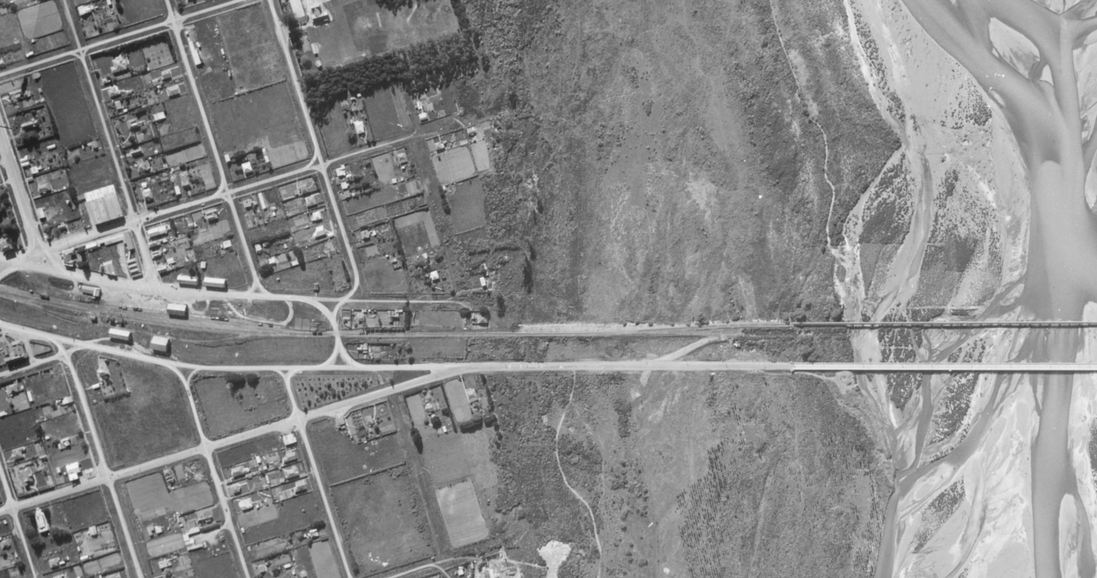
North end of Rakaia and the bridges. In 1942 the separate road and rail bridges were relatively new. Possibly the white appearance of the road bridge might be down to concrete bridges not being sealed over with tar as they are today. Although this bridge was "state of the art" when built, it is considered narrow by present day standards.

Rakaia Today: Any traces of the railway station and platform are long gone. This image from Google Earth is of the Railway Tavern which is directly across the road from the former station in Railway Terrace West.

These premises in the south end of Rakaia were among several that were siding served in the days of rail freight. More information on sidings will be shown in due course when the 1974 aerial image tiles for Rakaia are generated and the layout traced, as these particular images are high resolution and therefore well detailed.
Apart from the Rakaia map tiles still under preparation, tiles now exist for every one of the branch stations. However mapping has not started because of a consideration that a day might be spent at the local Archives New Zealand office to obtain NZR diagrams for every station. I have compiled lists of all the files held and am making preliminary enquiries with ANZ Christchurch office with a view to accessing these files in order to extract the required information from them.