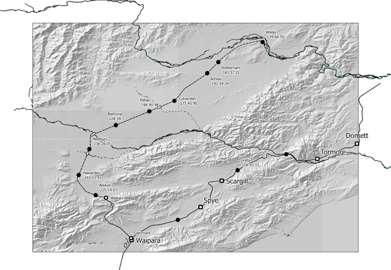
Since I last wrote about this two days ago, the option of producing maps via SVGs has come into consideration, by way of discovering the print composer feature in Qgis. This would be a great way of working around some of the issues in producing maps similar to Q4 from Qgis. For example, as we noted, one of the issues so far is to be able to put captions onto every feature that we want to label. Let’s say I choose to label my map with just the stations captions which are auto generated from the attributes table columns in the layer shapefile. I have put in the terrain relief shading as well. I then opened my print composer, put in the map, scaled and panned it to the part that I wanted to see, and then exported it to SVG. To get something that can be posted in this blog, I opened the SVG in Inkscape and then saved it to the PNG shown below.
As you can see, there are some edges to be cleaned up. This is due to a limitation of the Qgis SVG export plugin. That would be part of the image to be fixed up in Inkscape. After that, the next step would be to add the text captions you need. Those next steps will be what I will be investigating tomorrow. Since I haven’t used Inkscape before, the next thing I will need to do is find some online tutorials. The above map depiction, of course, is greyscale and it is quite an addition to the current Q4 mapping and probably the most significant enhancement. It depends, of course, on whether it is cost effective to produce the maps in greyscale, rather than all black as they have been printed in the past. I am pretty pleased with what you can see in the above picture, but it needs more captions to be added and these will have to be done in Inkscape which handles SVG as a native format.
Therefore the production of maps electronically for a printed replacement for Q4 (e.g. Q5) would require, first of all, generating an output from Qgis for each page as an SVG, and then editing that SVG in Inkscape to add captions or other text for any additional preparation needed for that page. From there the graphics are put into a source document which is used to produce a publication. One important difference is that Qgis lacks the ability to rotate the maps from a north-up perspective which is the default setting. In the Print Composer you can rotate the display of the map but captions don’t remain in the same orientation as before, which is an issue. It may or may not be possible to fix this in Inkscape, but I’m not going to make any assumptions on that, since I don’t know much about how Inkscape works just yet.

