Saturday 30 December 2017

MSL Dunedin [2F]

Pretty much like the last one except where you can see upper left, the irregular shaped area that has been masked in. Bits you can see on the edges, on the other hand, are simply overhangs outside the Linz aerial tiles that won't appear in the finished result (the reason you can see them is because the canvas has a few blank areas on it due to the Linz images not taking up the full canvas).

So maybe just another day to finish the masks then as per usual we spit out the tiles to load back into Qgis to draw the maps straight onto. And that's for 1978. I feel sure there will be older imagery available, so if 1960s or even 1950s comes out later on, I will do another generation, but I am not going to do multiple generations for such a large area as I have for a small number of station.

MSL Dunedin [2E]

This is what three historic aerial photos covering the area from Water of Leith to Andersons Bay Road look like. After a long complex process of sizing and rotating I have these all lined up ready for the masks to be done on the 2013 Linz aerial imagery. The masking is complex because rail tracks used to cover a lot of area in this part of Dunedin, as they went around various industrial areas and across wharves. I am trying to mask out as little as possible of the current day imagery which means a lot of work selecting just the areas that have rail tracks in them, and so far I have only done a little.

At the same time it looks like I am possibly converting all my Qgis projects back to version 2.18 as I have all but decided to ditch the development masters. At this stage I am not sure what work is needed, but the project files for 2.99 are only partly readable in 2.18 so some areas of layer styling are going to have to be hand ported per project. I have just finished setting up the testpc with Debian 9.3 and Qgis 2.99 and put 2.18 on mainpc to start the work of backporting projects with.

Friday 29 December 2017

MSL Dunedin [2D]

A 1978 view of Wingatui, with the station to the right. The Main South Line can be seen heading into the Wingatui Tunnel upper centre, while to the far left is the old single track route into the Chain Hills tunnel, closed some 65 years previously.

MSL Dunedin [2C]

Just another quick update to the earlier article.

In 1978, Dunedin Loco's turntable was opposite the intersection of Cumberland Street and Wolseley Street. Along the edge of Cumberland Street can be seen a pair of wagon turntables. These were a quick and easy way of getting a siding into a premises that was right next to the railway line, however the premises had to have their own way of moving the wagons between the turntable and their building as regular shunting locomotives could not traverse the small turntables. Particularly with the right hand example, you can see the track at right angles crossing the main road - which was possibly disused by that date, and the track in the left hand case has been removed or buried. The series of buildings on the right hand side of Wolseley Street still exist to this day - the left hand building is now a Z service station, while the loco turntable site is a BP service station.

MSL Dunedin [2B]

This is just a quick update to the last post and shows the area of Dunedin I will be starting with. As it is easier to divide things into sections, this part I am calling "City" and it will cover the area between Ravensbourne and Kensington (exclusive). 

This shows the rough layout in Gimp (I still have to snap and align the images at the edges) whereby we are using 12 of Linz's aerial tiles to do the overlay and masking of the aerial images. This means there will be 12 custom tiles to load into Qgis to do the mapping off. As such there is quite a lot of work needed to pull in and align all the aerial images so this will take a few days to complete, prior to starting the actual mapping.

MSL Dunedin [2A]

It does seem like a long time but it was only in August that I posted the first article in the Dunedin series. There is now going to be a series of articles covering Mosgiel to Dunedin, starting from the Dunedin end, to link up with the Otago Central maps as they get completed back to Wingatui. Now using Retrolens, I can get detailed coverage of Dunedin from 1978-9. The ideal would be that it was from the 1960s or earlier, but 1978-9 is what is available at this time, and it's very good stuff too, with a scales varying from 1:3000 to 1:8000 available. There is also a possibility of covering north of Dunedin to Port Chalmers in time, but that is not a priority at present.

The earlier article which has been retitled MSL Dunedin [1] showed the central city railyards and maps using the current Linz aerial coverage but not anything historical which I did not have at the time, so the first step is to overlay the Retrolens coverage onto present day Linz stuff and then work from there to map Dunedin as it was in the late 1970s. 

The maps will be especially interesting heading south from Dunedin where the motorway construction in the 1980s has changed so much through Caversham and that is with my typical map style of overlaying the historical onto the present and publishing both together, in this case I will set up the masks to show just the historic rail corridor over present aerials as well as publishing a separate map set showing the rail detail over the 2013 aerials. Included in this of course is documenting as far as possible the pre-1914 corridor through the single track tunnels. I have attempted to do this many times and the best conclusion is that this is more or less the route followed by the motorway through Caversham and in pre-motorway times it was just at the top of the cutting that the railway is in now, it was very close to the present corridor all the way where it actually deviated, which was past Caversham station, because a lot of the route from Dunedin to Caversham was simply regrading and doubling of the existing route as far as possible. It was mainly around the two tunnels that there was significant realignment and straightening because there were no stations in these sections, only at the ends of them.


Wednesday 27 December 2017

Otago Central Railway [56B]: Wrapping up 2

Well I have just completed a visit to Dunedin which included two full days at Archives New Zealand's Dunedin branch. The following research materials were copied during my visit:
  • Otago Central chainage charts for 0-25 miles
  • Some parts of the 25-146 miles chainage charts that were blurry on the copy I received from another researcher
  • Plan showing the 102 mile deviation and another showing the original route
  • Details (including plans and sidings) of Alexandra, Ida Valley, Auripo, Waipiata, Hyde, Flat Stream, Deep Stream, Matarae, Mt Allan, Little Mt Allan, Christmas Creek, Hindon, Parera, Salisbury, Hyde Ballast Pit, Taioma
This information was gained from something like 100 different files.

In essence this enables the maps to be substantially completed with diagrams of almost every location for which aerial photos are not available so as to make the maps the most complete that they practicably can be. It was not possible to locate the Reefs stations readily in file titles so they are among the few missing.

Work will continue to complete the maps in accordance with the publication timetable of Parts 2 and 3 of the article series which is going to be happening for about another 3 months or so.

Saturday 23 December 2017

Otago Central Railway [57C]: Otago Central / Taieri Gorge Railway Unconfirmed Bridge - 18 3/4 Miles

A file in Archives Dunedin dated 1913 refers to a bridge built at 18 3/4 miles which had 8 spans each 13 feet long, a total of 35 yards length. As no other information to corroborate the existence of this bridge has yet been found, it must be marked as hypothetical. It would have been as shown between Bridge 13 and Tunnel 7, between Machine Creek and Deep Stream.

One possibility is this bridge could have been replaced with a culvert, however there is no such structure recorded at this location in the chainage charts. Another possibility is that like Bridge 13A referred to in a recent post on this blog, it was a temporary structure later removed (although the file suggested it was to be made permanent). Bridge 13A was built to cover a slip and this could also have been the situation with this location. A close examination would confirm details such as whether a retaining wall exists in this location to enable the void in the embankment to be filled in. I don't have the ability to accomplish this obviously, so the bridge will remain on the map marked as shown above.

Friday 22 December 2017

Otago Central Railway [57B]: Otago Central / Taieri Gorge Railway Bridge 9A - 16 miles 23 chains

In 1911 NZR signed a lease agreement with the Taieri County Council for the construction of a stock walk on the east side of Bridge 9 (Taieri River) and the erection of overhead stockbridge Bridge 9A at 75 yards north of Bridge 9 as shown in the left of this map.

In 1964 the lease ended and was replaced by a level crossing right established across the Hindon Railway Station yard as seen to the right of this picture. The footway and overhead bridge were removed subsequently. The need for these structures ceased at the time because a new road bridge was built over the Taieri River as seen in the middle of this map.

Sometime in the mid 1990s the road bridge was undermined in a flood and the Dunedin City Council which has a majority shareholding in the Taieri Gorge Railway and is also the current local authority for the Hindon area, decided the best outcome would be to convert Bridge 9 to a combined structure with a single shared deck for both road and rail traffic. The old road bridge was removed after new connecting roads were built to either end of Bridge 9 and the road across Hindon railway yard was closed.

The improved road access to Hindon in the 1960s was instrumental in closure of the siding at Christmas Creek on the south side of Bridge 9. Many small stations in the Taieri Gorge were largely maintained as the railway provided the only form of transport until comparitively recent times and it is somewhat surprising Bridge 9 was not made a combined structure from the outset. On the other hand, the TCC would have had to pay NZR considerably more maintaining the deck of a combined bridge than the 15 pounds they paid annually for the stock walk and overhead bridge. Hence it may well have been decided that this was a more economical solution but this is pure speculation on my part.

Little Mt Allan is another example, only one or two farmers used it, which was not enough traffic to have a siding put in, but with no other access to the area, wagons were loaded or unloaded by trains stopping on the main line by special arrangement. Taioma is another example, the access issues here were solved by moving the station closer to Wingatui where it was more accessible for the sole farmer of the area, Mr G Webb.

Otago Central Railway [57A]: Otago Central / Taieri Gorge Railway Bridge 15A - 21 miles 15 chains

Bridge 15A at 21 miles 15 chains near Deep Stream in the Taieri Gorge was built in 1913 to bridge a 100 foot washout. In 1935 it was replaced by a new embankment with a concrete retaining wall.

Otago Central Railway [56A]: Wrapping up

Well the OCR maps are humming along nicely but naturally I am looking forward to wrapping up that part of the project. Right now I am working on tidying up a lot of loose ends as I get ready to write Part 3 of the article series.

Three weeks ago I wrote about some areas that have limited aerial coverage. The best way of fixing that is to get station plans, and at the moment I am working on that. Basically that will include Ida Valley, Auripo, Ranfurly, Waipiata, and probably some of Wingatui-Sutton. So that means all those maps can be drawn properly without the aerials. It just means you won't see a historical aerial for those areas, but you will still see a station diagram.

It would be nice to get some of the Taieri Gorge and I hope that will be possible.

Monday 18 December 2017

Volume 10 created on project website

The Volume 10 section of the project website has been created, and the home page updated accordingly.

Volume 10 content is currently the posts on this blog with that label, Waipara maps as posted on this blog earlier this evening and the source aerial photos from Retrolens.

Waiau Branch [1J]: Waipara 1995

This is pretty much the way Waipara is today. The main changes since the previous photos (the date 1995 is an approximation) are in the removal and replacement of the passenger platform and station for the Coastal Pacific Express, and the erection of the Weka Pass Railway carriage shed with its attendant and companion sidings alongside. To reach these sidings an extra piece of land formerly part of the Rural Fire Brigade HQ has been acquired.

Waiau Branch [1I]: Waipara 1990

In 1990 the main changes are that the yard has been reduced; there is now just the main, a longer loop and a public siding to the loading bank; the goods shed and triangle have been removed. Weka Pass Railway has opened their engine shed with three tracks. The connection between their yard and NZR has been formally converted into a private siding with a switchlock, recognising their establishment as a separate owner of the old Waiau Branch. At the south end all remaining parts of the Way and Works depot have been removed except for the relatively new main buildings which are now vacant. (This map uses 2015 aerial photography)

Waiau Branch [1H]: Waipara 1985

The changes being seen now are much more. Weka Pass Railway has been in operation for only three years but have already managed to start building an engine shed near the old stockyards.  The trolley shed at the north end of the station has been replaced by a new one at the south end, while the siding into the way and works depot has been removed; by this time the main part of the depot is closed.

Waiau Branch [1G]: Waipara 1979

At the north end there have been some changes in track layout between the branch, branch platform sidings, main and loop. At the south end the main difference is the country works depot being built, the engine depot facilities have completely disappeared and the singleman's quarters ("the kennels") have gone.

Waiau Branch [1F]: Waipara 1972

Between 1961 and 1972 the main difference visibly is in the number of houses. The stationmasters and signal maintainers house have disappeared from their distinct locations, along with a number from the row of 12 bisected by the triangle. Although the engine shed is by then vacated, it is still in place.

Waiau Branch [1E]: Waipara 1961

Since 1950 there are not many changes in the yard. Mainly in the number of houses, and the appearance of the social hall marked A at the north end.

Waiau Branch [1D]: Waipara 1950

These are of the 1950 aerial image of Waipara. The buildings are correct, but the track layout is uncertain due to poor resolution.

Sunday 17 December 2017

Waiau Branch [1C]: Waipara 1950

This is a very quick comparison shot of Waipara in 1950. See my previous post for more detail of what the buildings are.


Saturday 16 December 2017

Waiau Branch [1B]: Waipara Station history

Once again this article is not in either a MNL or Waiau Branch series, because these pictures are another set of samples rather than a complete set of maps for Waipara. I am warming to the idea of doing a Waiau Branch series, and also adding the 1950 aerial of Waipara to the 1961, 1972 and 1979 ones I already have, for a specific set of maps for that date. There was an aerial series produced in 1934 which I can't find any trace of, and there are probably also later ones but I haven't yet attempted to find any details of such, so at the moment there is a big gap from 1979 until 2015 or 2016 when the current aerials were produced.

These aerials and maps just show buildings and structures rather than tracks, and all buildings/structures over the whole site rather than generations, so hence it is not a full set of maps. The aerial photography is the current colour stuff from Linz.

Les Dew's book pages 144-161 have helped fill in much of the detail of what each building was. Every building or structure is traced from an aerial photo in its actual position and the styles indicate the status of each:

  • Black - an existing railway building/structure (either KRL or WPR)
  • Grey - a former railway building/structure (that doesn't exist any more).
  • White with solid border - an existing building that may or may not have ever been a railway building in the past.
  • Transparent with dashed border - a former building (gone) that was never a railway building.
The letter codes are described below each map as they are used. The map key on the maps website is now out of date as one code has been added and the meaning of another code extended. The number and position of the railway housing has been taken on the basis that Dew's map shows the railway houses.

Starting with the south end of the yard.

Mostly what was at this end are the NZR engine shed (E), way and works depot and other various sheds including the country works depot which still exists (D), the various houses (H) including at upper left "The Kennels" which was the singleman's accommodation and the stationmaster's house near the way and works depot, and as we head to lower right, the Weka Pass Railway rolling stock shelter (R), the original goods shed (G), loading bank (L) and the original platform and station building (S).

Note there are not many of the original 16 or so houses still there today. Some have been long gone; others have disappeared more recently in private ownership.
Now let's look at the north end:
There is a bit of an overlap so I will just go into the middle. In upper centre labelled (A) is what used to be the Waipara staff social hall and is now the staffroom for the Weka Pass Railway. Directly below that is the former stockyards (Y), the Weka Pass Railway engine shed (E) and the old footbridge (B). Then there is also the present day KRL platform and the station building (S).  To the right of the stockyards you can see where a privately owned building used to be, where some of the Weka Pass Railway's yard tracks go through. It's evident that a strip of land at the back of that property must have been sold to the WPR to enable them to put the extra tracks in for their rolling stock shed and the storage tracks next to it, as this land was never part of the railway yard.
So there are our set of maps/aerials just for starters. When I get on to doing MNL stuff again next year some time after the Otago Central stuff is complete then I will do a full set of maps of 1950, 1961, 1972, 1979 and also try to find out what other generations I can find because something like 1995 or 2000 would be really good to have as well, and of course all the various tracks can get drawn in as well. I have just kept them off for now because there is no point in having a track going through a building when the track and the building/structure are from different generations, and the purpose of these particular maps is to show all buildings or structures of all generations on one page, as just a quick introduction to the history of Waipara.

Friday 15 December 2017

Waiau Branch [1A]: Waipara aerials 1972/1979/2014

Although there will be a series for the Waiau Branch in due course (MAYBE!), here are just the aerials to date for a preview. No maps on them as yet.

These aerials are a composite of 1972, 1979 and 2015 imagery. When the maps are eventually drawn there will be two different maps - one for the 1970s and one for the present time, due to the changes in the yard since the 1980s.

After looking at the book and the 1961 aerial photo I have found additional detail in 1961 that I will add in later.


New compositions [2]

Following on from the previous post about discussing where things can go after Otago Central I have been looking at aerial imagery available for North Canterbury (Waiau Branch and MNL) and Hawkes Bay / Eastland (NGL). At the same time I am also looking at Volume 12 completion (Kingston Branch and its various branches, but not quite as actively.

With the reopening of the MNL (the highway officially reopens today) it is opportune to look at completing those maps and with the discussion about reopening part or all of the NGL (and also a friend has just moved to Napier) that is also timely.

So I have obtained the aerial photography for the Waiau Branch route to add to the earthquake coverage of the MNL which I already have. The route of the branch is nicely covered by relatively recent 0.3 metre resolution imagery which is a nice sharp resolution, although somewhat washed out in appearance as it must have been taken on a very bright day.

I have aerial images of Waipara from 1972 which will be put into this Gimp project when I have some time and then it will all be detailed in due course. 

So here is the roadmap for Volume 10:
  • Waiau Branch all stations detailed (fortunately where the aerial coverage is not such a high resolution in a number of areas I have Les Dew's book to help out)
  • MNL using the earthquake coverage only except for historical detail of Picton and Addington-Rangiora already done AFAIP
  • Oxford and Eyreton Branches finishing the historical detail already done AFAIP
And that is all the work needed for Volume 10. Should be easy, right? Except that a lot of the Addington-Rangiora stuff is a mess because of multiple times the Christchurch stuff has been changed (project and data formats/structures etc).

I'm not going to give a timeframe or priority but let's say I expect to progress that in the first half of 2018.

Napier-Gisborne Line in Hawkes Bay also has nice recent 0.3m imagery all the way to the boundary. Here is some around Wairoa:

(Note the km pegs are not likely to be published in a volume or the official maps online as they are probably KRL copyright information and I can't be bothered at this stage contacting KRL to see what their views are.) This is an old project by present standards - last used nearly 18 months ago and still in EPSG 4326 so it has to be converted to EPSG 3857, since all the aerial imagery is in the latter CRS. 

On the Gisborne side the available aerial imagery is 0.4m resolution dating from 2012-13. Still reasonable - some of the older Linz stuff is 0.7m for the Otago Central so it's quite good at 0.4m. As it happens there is 0.1m coverage of some urban areas, which is Muriwai and the Waiapaoa Bridge all the way into Gisborne.

So here is a roadmap for Volume 5:
  • NGL may or may not have all stations detailed - I am not making a firm commitment even though I have good aerial coverage for practically all of them.
  • What I will make a commitment to is the historical coverage of Napier, Wairoa and Gisborne, plus the basemap stuff anywhere else along the way.
  • Sometime in 2018 (no firm dates of course).
And here is a roadmap for Volume 12:
  • After finishing the Otago Central Railway then the Kingston line and its branches but not at a full level of detailing. I will look at detailing any branch junctions and terminii and possibly Riverton but I won't absolutely commit to those as I haven't checked out the full level of available imagery and do know that for some of the areas good coverage isn't available.
  • Volume 12 will be finished probably in 2018 but I haven't decided the priority. It is highly possible it could just be rushed out as is (without any more work on Kingston Branch stuff than what I already have) and adding any more detail is just left for sometime further down the track.
So there is some kind of development roadmap going forward. 

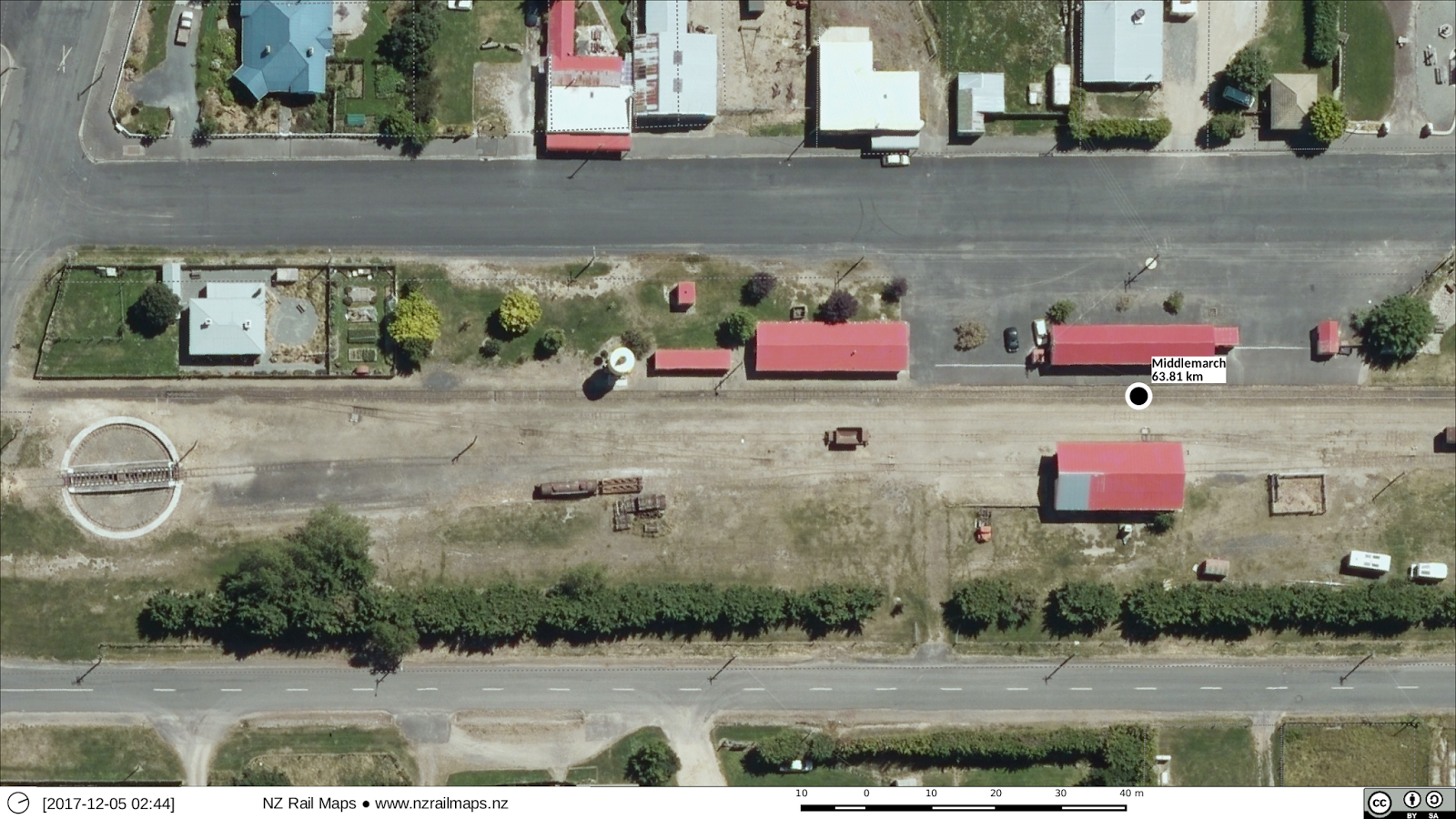
The priorities are largely geared around communities of interest. The Waiau Branch has a significant community of interest with which I have historically strong connections although going back roughly 25 years since I had any significant involvement. I don't expect the same community of interest for the NGL or Kingston so they are much lower priorities. The MNL as a whole has significant interest because of the quakes but not enough to bother detailing the historical aspects of much more of it than the branch lines. Of course the Otago Central railway has the biggest community of interest and that has largely driven the intensive development of the maps for the area.

Getting the aerial photography for even the current basemap is a big step in itself - four separate downloads for NGL for Hawkes Bay because of the download size limit of 3.5 GB - and then picking out just the imagery you need and deleting the rest because it gobbles up disk space - I'm down to 50 GB of free space on a 2 TB disk volume pretty quickly. So a lot of work just for that. If I do Linz basemap coverage for every area that is a lot of work and I expect that I will. Have to start deleting some of those virtual machines I have been testing Qgis on. Now that I have a second computer at my desktop running Qgis as well I can work on two projects at once without using up the RAM on the mainpc running a VM. The second computer only has 8 GB of RAM but that will have to do as another 8 GB would cost $150 and that is just too expensive. 

Thursday 14 December 2017

New compositions

My last post looked at what could be done in terms of mapping more detail (i.e. drawing station layouts etc) which has largely been done by photoshopping the historical aerial images over the top of present day ones, which makes it very easy to draw the track layouts on them. Most recently this was done with the Cromwell Gorge, which as the progress reports show, took a week's hard work to complete. The result has been much better than the earlier efforts which just showed where the railway line went relative to the lake shore and didn't show any of the historical detail that disappeared below the waters.

My next achievements will be similar but much less ambitious. The first of these is to map the old WMR line between Johnsonville and Tawa. This is one that really has disappeared off the face of the earth over the last 80 years, being almost completely built over as of now. So it is somewhat comparable to the Cromwell Gorge. Unfortunately I can't get coverage of when it was open, the earliest available is four years after it closed.

After that, I am not sure what else there is in NZ that can be comparable. I suppose stuff like the old railway over the Rimutakas or the original railway to Tauranga could be similar, but they would certainly be less interesting. There isn't actually that much aerial coverage of the old Rimutakas at this stage.

Getting all the stations on the Napier Gisborne Railway turned out to be interesting because there is aerial coverage of virtually every one. But whether I will map them up, remains to be seen.

I don't have much interest in working with any other branch lines except for the Waiau Branch previously mentioned - there is reasonable coverage of most of the stations along it, but I don't have much interest in mapping these at this stage.

Wednesday 13 December 2017

Maps Project Development in 2018

As we can be aware the development of maps for the Otago Central Railway has been a very intensive effort. This is in no small way due to the level of public interest in the line because of the Rail Trail. At the same time I have had a good level of interaction with the historical community in Central Otago of late and this is I suppose the kind of thing I would want to see as an outcome from developing these maps. It does actually for me justify going outside the railfan community to find a wider base of interest.

I am not anticipating there will be such a base of interest for much else in the maps project so the level of development will be smaller and lesser. Once the OCR is finished the main focus for everything else will be prioritised into getting them into publication just about where they are now, given I already have the maps complete for nearly every other part of the country.

If there is any more intensive development of any part it will be out of personal interest in specific routes which I have an interest in e.g. the Waiau Branch and some other areas of Canterbury, and parts of the railway network around Wellington, Wairarapa, Hawkes Bay and Eastland. But that doesn't guarantee more detailed maps as it depends on how much effort I can be bothered putting in.

Otago Central Railway [55]: Poolburn Deviation

Information from a file held in Archives New Zealand's Wellington office was forwarded to me today. This is just 2 pages referring to the need for a deviation at 102 miles and the approval from the General Manager of Railways for the deviation to be carried out. The date of the approval is 1909, five years after opening the line. The alteration does not appear to be marked on the chainage charts I have.

Monday 11 December 2017

Seasons Greetings to our readers

Since I have finished Part 2 of my series of articles upon the Otago Central Railway, I now have breathing space to have a break over the holidays. Although stuff will still be happening I won't be blogging too much for the rest of this year.

Nevertheless before too long the Part 3 deadline will be with us. To fully inform Part 3 requires extra information which I hope will come in within that time - more aerial photos that currently aren't available of some stations such as Ranfurly, Waipiata and those within the Taieri Gorge - and other info including a file on the Auripo realignment that I have ordered a copy of from Archives New Zealand.

Somewhere between now and Part 3 being published I have to finish all the maps of the entire line to a reasonable standard. This in turn will let me go ahead with putting together the first part of a map book for Volume 12. The rest of the map book is mainly about the Kingston Branch and its branches, so I will need to do the work on finalising the maps of this section of line as well. However as far as the Kingston Branch goes, there is not likely to be much revision and all that will happen is it will be reviewed by comparing the maps to the current Linz aerial photography of the region.

After that it will be time to have a look at what is needed to finish maps for the rest of the country. In the past I have put out several other map books and published online maps for various areas. I will have to look at what is needed to get the maps out for these areas as probably new map books will be preferred. Having removed all the maps previously that were on Flickr, I need to put the maps onto Google but I guess they may well be republished and updated first.

However I need to make it clear that the maps for the rest of the country will not be completed to the same standard as Otago Central even if I do use Retrolens aerials. There simply isn't the time for me to put the same resources into the other maps as I have put into Central Otago, and that was always the intention from day 1. Most of the other maps have already been developed and really it is just a time for finalising and publishing them.

Otago Central Railway [54]: Published, part 2

Part 2 of the OCR series of 3 articles has reached deadline. The magazine will be out in about 2 months, so watch this space.

It covers the line mainly from Alexandra to Ranfurly.


Saturday 9 December 2017

Otago Central Railway [34F]: Clyde updating 3

So here finally are the aerials for Clyde completed. The new Clyde area is for two eras, 1977 and 1981, and the old Clyde area is for 1962. 

The maps will be updated when I have time as it is somewhat doubtful in this festive season that I will be able to do any more major map work before the new year.


Friday 8 December 2017

Otago Central Railway [34E]: Clyde updating 2

Getting the new aerial photos for Clyde together has been slow because of other priorities at a busy time of year. Getting the maps updated may not happen now until early next year, hence another article about Clyde instead of the completion of the maps. In fact I am probably not going to get any more work done this year other than finalising Part 2 of the article for publication.

One thing that is missing is pre-1968 coverage of the north side of Clyde where the depot sites were that would show what the NZED site originally looked like. Survey 1452 which I have used for the Alexandra-Cromwell historic maps since it dates from 1962, appears to be either a part survey of SH8 (Roxburgh-Twizel) or a hydro survey, and has only a single line of images all the way along. Survey 1843 of 1966 may have an image that is suitable when Retrolens scans it. So this means the earliest I can have at present for these areas is when the NZED depot was already in place but before the MOW depot was built and the rail line altered at Clyde.

The aerial photos of the new Clyde yard are also shown. What you can see here is basically raw screenshots from Gimp. There is still quite a bit of work to do before I can have geojpegs for Qgis.

 This one uses a 1970s historical view of Clyde with just the NZED depot in place.
This one uses the 1981 NZR aerial survey of Clyde. This aerial was at quite a large scale and so on the image you can actually count the railway sleepers. But there are some gaps that will have to be filled in with another aerial from the era.
Here we are using 1962 aerials from Survey 1452 to show the old Clyde yard.

Thursday 7 December 2017

Otago Central Railway [34D]: Clyde updating

As the below image shows I am currently working on updates for Clyde with historical aerials. This is a more complex task than some of the others, even the Cromwell Gorge task, because there will be multiple images for some areas, and because of the overlapping multiple present day images. So it will take a while longer to put together all the images I am using and that's why this update is being posted for now.


Tuesday 5 December 2017

Otago Central Railway [46A]: Middlemarch Intro (Updated)

As an introduction to Middlemarch here are comparisons between 1965 and 2013. Note the differences in the houses and station buildings. The maps will be drawn in due course.


The main changes in the yard buildings are the works depot and trolley shed to the south of the station building, obviously post 1965. In the mid 1960s the small way and works gangs were amalgamated into four big ones based at Wingatui, Middlemarch, Ranfurly and Alexandra (D&E 4th ed p.78). All of these sites gained works depots. The Wingatui depot is now used by the Taieri Gorge Railway, and I presume they also use this one at Middlemarch, while the buildings still exist in the Ranfurly yard. The buildings at Alexandra have been demolished although the trolley shed foundation can still be seen in the yard.

A quick perusal of the chainage charts shows many more details such as the engine depot and approximately two more houses that are not seen in 1965 and probably not in any earlier aerials that may exist. I haven't been able to find out anything about the engine depot so whether it existed beyond construction days - it may have been built by PWD for the construction work and not taken over by NZR. The turntable is a different story, installed in 1922 it was removed in 1972, but in more recent times has been reinstated by the Taieri Gorge Railway.