Showing posts with label Midland Line. Show all posts

Monday, 23 December 2019

Midland Line [0G]: Volume 9 Progress Report 7 (Greymouth-Ross)

So we have spent the past few days working to make up maps for the part of the Midland Line that is mostly a branch off the main line, the branch that goes to Hokitika (Hokitika Line) and which was formerly the Ross Branch that carried on past Hokitika to Ross.

From Ross there was a tramway built in 1919 by Stuart & Chapman to Kakapotahi and further still into Ianthe State Forest and this continued to operate until 1959. This supplied the logs to the sawmill at Ross and this mill with its own network of private sidings connected to the railway provided a lot of the traffic that was conducted at Ross. The mill did continue to operate for some years after the tramway closed as logs could be brought by road and other companies also brought timber to Ross for loading.

There was also a sawmill and settlement at Ruatapu, between Hokitika and Ross, and this still operates to some extent today. We haven't got anything for maps on Ruatapu at this stage. What we have got south of Hokitika is just Ross and a bit of the tramway further south, which at one stage was considered to become an extension of the railway. We have located all the stuff we copied from ANZ's files earlier this year to use for map drawing and with a limited number of lower quality aerial photos and the research information we can draw maps of Ross and parts of the tramway.

Greymouth-Hokitika is more promising and after looking at what can be seen on aerial photos from 1963, which is specifically for State Highway 6, we can draw in maps of Kumara and Arahura.

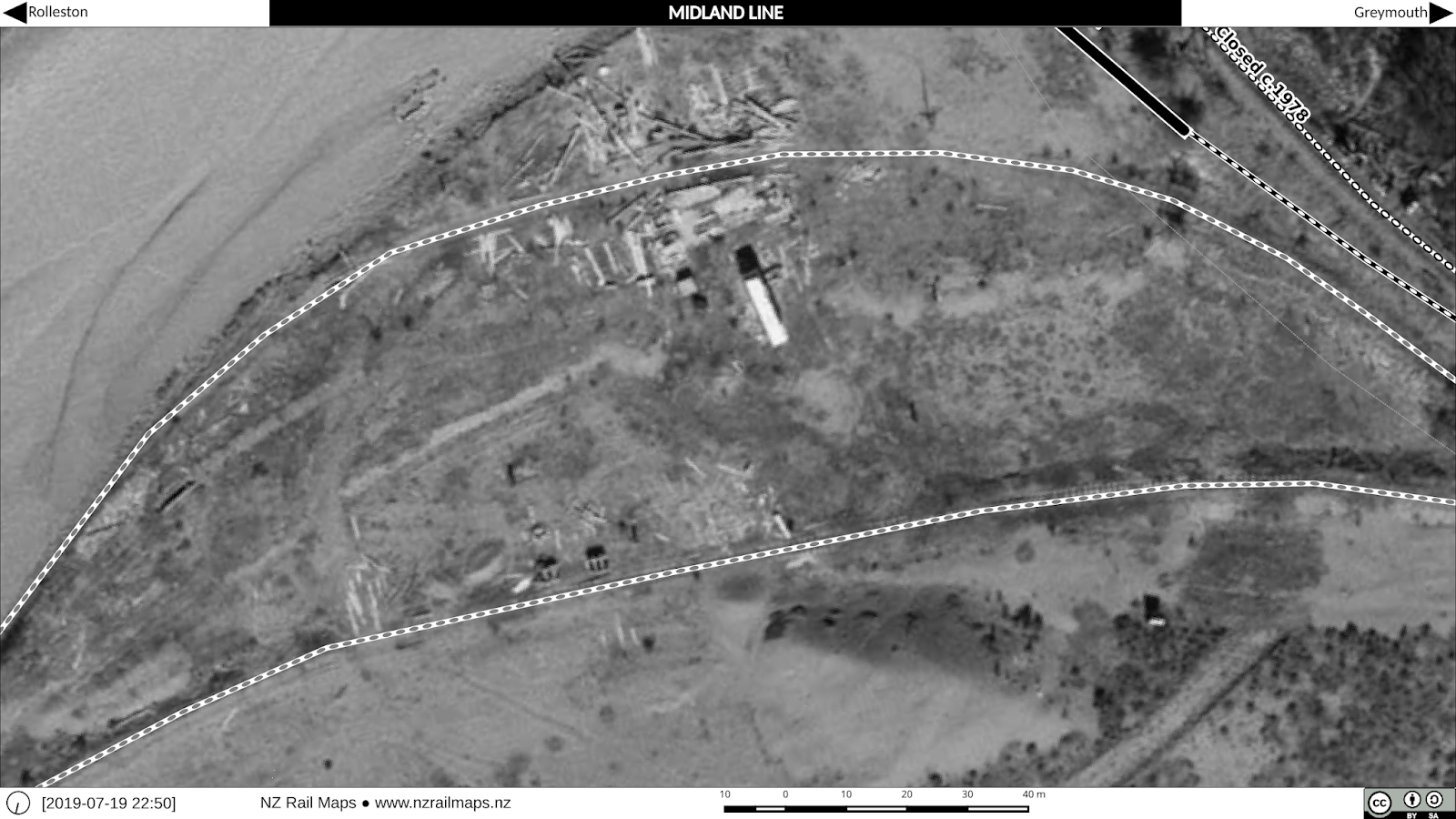
We also have good quality coverage of Greymouth (1945) and Hokitika (1963) that is being worked on and the maps of Hokitika itself are virtually complete and will be published soon. Greymouth itself is going to take the longest because research is needed which hasn't been completed yet and maybe not until early next year. However here are some maps of Elmer Lane taken in 1945, 1988 and 2016.


Thursday, 19 December 2019

Midland Line [0F]: Volume 9 Progress Report 6

Last time we had a look at the Midland Line, back in August this year, route alignment was completed to Otira and some other work was being planned. However it is now a priority to make progress on completing all map volumes to a basic standard over the next 12 months (calendar year 2020), which in theory means completing one volume a month.

Accordingly, the next step for the Midland Line (Volume 9) maps, which is the main line from Rolleston to Greymouth and its various branches, is to achieve this basic standard completion, which is going to be achieved by using the WMTS capability of Qgis to obtain the most up to date Linz aerial photography of the route, and aligning the main line and any other tracks visible accordingly, then filling in the other details. 

Once this Basic standard has been achieved there may be time to look at filling in some other historical details that haven't been achieved to date, such as those referred to in previous posts in this series. Since Retrolens now has good enough historical coverage of Greymouth and Hokitika, we will have a look at incorporating some of this, depending on the quality, as there are no NZR surveys of these areas available yet. Apart from other stations previously mentioned, the available coverage of Stillwater may prove suitable for mapping but it is not of a high quality and mainly has only historical interest in locating a few features.

Research has been undertaken previously for some key stations along the route such as Stillwater, Hokitika and Ross, but not Greymouth.

 Ross railway station in 1948. On the left are the railway houses. At upper right is the sawmill which created much of the traffic volume at this station, with its own siding complex. It was served by a tramway that ran further south to Ianthe, which closed in 1959. There were investigations into extending the railway along this tramway route during the early 1940s.
Just one part of what is covered in Greymouth, this is the Elmer Lane roundhouse in the 1940s.

Friday, 29 November 2019

Railway Housing in Greater Christchurch [1]: Introduction

As we all know, when NZR developed their network, staffing requirements especially in remote locations often required housing to be provided. There are a number of townships in NZ where the amount of railway staff housing was significant compared to the overall community, including several railway towns - Otira on the Midland Line being one of the best known examples and one of the few that is still substantially unaltered today.

In the course of the Greater Christchurch research several housing settlements have come to light around the city, some of which have long gone and others which still exist in some form, however in general Kiwirail does not have any houses of its own these days and only occasionally leases properties as needed such as at Otira. At a major station there would generally be a stationmaster's house which was separate from most other housing, the latter tending to be a row of houses close together, and generally without driveways or garages although a small shed was commonly seen on the majority of sections.

As we generally know, NZR housing became a major focus around 100 years ago to the extent that a housing factory was built at Frankton (the buildings still exist in some form) and prefabricated standarised designs were churned out for a number of years afterwards. Hence it becomes possible to identify ex-Railway houses by sight in some areas because of the characteristic appearance. Wherever possible, Railway housing settlements were often placed at the edges of railway yards.

We haven't specifically researched Railway housing in the Greater Christchurch area just yet but intend to do so as it is becoming a topic of interest and the map key does include a code for marking houses which has been undertaken on other maps we have developed, most notably the Otago Central line, so having stumbled across a number of files specifically related to housing in our research currently on Lyttelton, we now intend to research the housing more intensively in order to document it as part of the maps.

Our research some weeks ago on Christchurch Station, for example, documented that a house for the stationmaster may have been provided somewhere in the area in the early 20th century, but it was not too long before NZR started to pay their stationmasters allowances to live in their own houses elsewhere. For example, paying the telephone connection and monthly fees for the Christchurch stationmaster was undertaken for many years in recognition that they would be expected to be available on-call most of the time when not actually working.

Housing at Lyttelton appears to have been located all over the township rather than being clustered close to the station. So far we have uncovered that NZR owned houses as high up as College Road and Brenchley Road (these locations are near the northmost limits of housing development on the eastern side of the township). As our aerial photos at the moment don't go that high, we may have to extend them if possible in order to show the housing on maps.

Heathcote is an interesting place to investigate as well because a housing development was undertaken c. 1960 at Railway Terrace, between the upper section of Martindales Road, Port Hills Road and the Tunnel Road. At this stage we can only speculate that the intention was to provide for a number of staff housing needs in the general area rather than specifically for Heathcote, as it is evident on the map that there were approximately 20 houses constructed, and Heathcote has never been a major station that would have required a significant number of staff - by that stage probably only a stationmaster and/or signalman. Since NZR sold the housing, some of the sections have been redeveloped but there are still some of the staff houses in place. Further research has yet to be completed on this settlement and the other NZR housing that is known to exist around Heathcote.

Then-new housing development at Heathcote in 1961. Martindales Road has been extended to give access to the tunnel road formation during the construction of the Lyttelton Road Tunnel project.

View of some of the wider area in 1970, including a water reservoir on the hillside above that no longer exists today.

Same view as the first map but taken 2015, the settlement has changed much but some of the houses are essentially the same.

No survey of railway housing in Greater Christchurch would be complete without looking at the settlements around Addington Railway Workshops. At this stage we know little about this housing except that due to the extensive changes in the transport landscape that have taken place in Addington over the past 30 years, even some of the streets these houses were in have disappeared.

The first area that may have been a railway settlement at Addington is directly north of the Shops site in Lowe Street. Earlier aerial photos show this was almost all in housing, whereas today there is hardly anything left due to it becoming mostly commercial and light industrial in nature.

Addington in 1940. The area that may have been a railway housing settlement is bounded by Lowe Street, Tyne Street and what later became Blenheim Road (known as Alliance Street at the time). There already seems to have been some industrial development in Pope Street in the area opposite the saleyards that later became the NZR Publicity and Advertising premises.

 The same area of Addington in 2015, some 75 years later. Tower Junction occupies the Shops site, and the housing has almost completely disappeared from view. In fact there was just one of the old houses in a run down condition which appears to the left and slightly below the 0.5 km peg. But the latest imagery from Canterbury Maps (below) shows it too has gone recently.

The other main area of Railway housing we are aware of in Addington to date is directly to the west of the Shops. This was never huge - there may have been only about 20 houses there at its peak - but the streets themselves were removed completely when Tower Junction was developed.

The NZR housing settlement in Margaret Street, Levin Street and Bell Street, as seen in 1940. There were still some houses there in the 1980s although parts of the land by that stage were being used for Shops purposes such as carparking. Clarence Street at that time was the major through route of the area, with a level crossing over the Main South Line just west of the present passenger station.

The same area much altered in 2015. Whiteleigh Avenue has become the major roading route with a new level crossing and Clarence Street is now closed off and (as Troup Drive) ends at the entrance to the present Christchurch Railway Station (Addington).

Tuesday, 13 August 2019

Project Diary 2019-08-12

This week we have switched back to the Christchurch area maps due to the impeding local government elections. We are currently working with several candidates and preparing material in order to assist some of their campaigns, in association with Christchurch Transport Blog.

Because of this the Midland Line work has temporarily halted, although research at the local branch of Archives New Zealand has continued. We estimate approximately two more days of research at Archives will be sufficient to complete the Midland Line maps, but are unsure exactly when these maps will actually be ready.

We are taking the time to complete more of the historical maps of Christchurch as well as some of the other stuff we are doing so I have pulled up a number of Gimp projects and revised them as necessary to keep them within reasonable file sizes. For the Main North Line it is now split into one project that covers Addington and Riccarton along with Christchurch (from MSL) and a second one covering from Bryndwr to Ashley, previously it was all one project from Addington to Ashley. 

For the Main South Line we have Lyttelton to Heathcote including Ferrymead in a project, then from Woolston to Waltham, then from Middleton to Hornby, and then from Islington to Rolleston. The reason Christchurch was put in with Addington going north to Riccarton was because we had Addington in two projects, one for the MNL and one for the MSL, which was an unwarranted duplication.The one we haven't started on really is Hornby to Lincoln, and it's likely we will take Hornby out of the MSL Gimp projects at this point and put it into the one for the Hornby Industrial Line.

It's timely to comment briefly about maps of local government boundaries. Linz Data Services does not have this type of map in the list of layers that can be downloaded through their site on Koordinates. However, Statistics New Zealand, another Government department, does have them through its Datafinder site, http://datafinder.stats.govt.nz also hosted on Koordinates. As a result we have taken the opportunity to download six layers together: Maori Constituency 2019, Constituency 2019, Community Board 2019, Regional Council 2019, Territorial Authority 2019 and Ward 2019. This information is needed in order to discover the boundaries of each of the wards for the Regional Council elections and in so doing, be able to assist certain candidates in the wards of the transport related issues in their constituency.

Friday, 2 August 2019

Midland Line [0E]: Volume 9 Progress Report 5

This is a brief update on progress with Volume 9. Currently we have completed the route alignment as far as Otira and the details of the Otira yard tracks are being drawn in. A decision has been made to use the available aerial photography we have as far as Kotuku to draw layouts of all stations for which the photographs cover west of Otira.

Route alignment which consists of drawing tracks and station markers is one stage of the mapwork and the second stage after that is to put in bridges, tunnels and milepost markers where applicable. We expect to push on with route alignment towards Stillwater, Greymouth, Hokitika and Ross, although the last section is mostly done already, so there isn't a lot to be done in that respect.

Visits to Archives New Zealand over past and coming weeks will fill in in the details of the major yards of Stillwater, Greymouth, Hokitika and Ross in lieu of any available aerial photography. We hope this should enable Volume 9 to be completed by the end of August.

 The location of Bealey Bridge is an interesting question. Working Timetables and Kiwirail maps place it on the eastern end of the bridge as shown to the right corresponding to 68 miles 45 chains. However NZR file information shows the placement of the passenger stop at the western end of the bridge corresponding to 69 miles.

The other question is the location of Bealey Quarry and at this stage we are not confident of being able to determine that with our current level of research.
 Apart from the ballast siding at Waimakariri Bridge there was also one at Cora Lynn for a period probably around the 1940s which is likely to be the one with wagons in it shown above. This was not a source of high quality ballast and was only used for emergencies.
Another location where ballast was taken along the Midland Line was Sawmill Stream at approximately the location shown above. Probably this dates from the construction days and only one reference to it from 1923 has been found so far.

Wednesday, 31 July 2019

Midland Line [4B]: Arthurs Pass-Otira 2: MRC Summit Line 2

Following on from last evening's post here is the rest of the Summit to Otira route. We are assuming plans will exist for the climb up from Arthurs Pass Station to the summit as there are many plans in the Archives collection, but few of them have been scanned as yet which will make it necessary for us to go through much of the remaining collection in the reading room whenever we have time. Of the ones that have been accessed so far we have been able to source the entire route down to well beyond Otira (at least 12 miles) and have used plans and drawn the route as far as where it comes alongside the existing route (5 miles) as the plans beyond that point are difficult to align to topography because they are so old.

Starting from the summit (the actual pass known as "Arthurs Pass") at 920 metres ASL and with a railway station marked as "Summit Station", the proposed line begins to descend towards Otira. The initial section being right alongside the highway and passing Lake Misery, the gradient here being 1 in 15.
At the 1 mile post the line has descended about 100 metres.  Shortly thereafter the location of "Kopeki Station" is reached. It's not immediately obvious why another station was needed so close to the summit. The origin of "Kopeki" is unclear, but there is also a creek of that name marked on the plans, which is what is known today as Pegleg Creek.
Kopeki Station would have been about where the road used to head up the zig zag. This notorious feature of the highway for more than 100 years was replaced in the 1990s by the present Otira Viaduct. At this point the proposed line left the proximity of the highway, understandably given the abrupt change in heights where the highway viaduct crosses the bottom of a big slip, and crossing over the top of the present tunnel it follows less undulating terrain further west.
As the proposed line crosses the slip above Park Creek it reaches the 2 mile peg. The altitude is now 740 metres, representing a descent of 180 metres from the summit.
 After crossing over the top of the present rail tunnel again, the proposed line reaches the site of "Flat Top Station". This was to have had a separate yard as a spur off the main line. The route then makes a big curve westward before it reaches the 3 mile peg, now at an altitude of around 640 metres. Again there is the question of why another station was needed so close to the previous one.
We saw this map in the previous post and here it is again. This one is scale 1:8000 (the others are scale 1:5000) to fit the entire curved section in, which would be extremely difficult to show otherwise. At 4 miles the altitude on the surface was 810 metres, underscoring the need for the tunnel to continue the descent through the hillside. Upon exiting the tunnel the 520 metre contour line is crossed and on reaching the 5 mile peg the line has descended to around 500 metres, about 20 metres higher than the present line. Considering that the present route is descending at 1 in 33 towards Otira station, the 1899 line still has to achieve very steep grades to reach Otira and there is a stretch of 1 in 22 along this section. See the comments on the previous post about the grades through the 3-5 mile section of the route. One of the old Midland Railway Co plans (drawn by the actual company) shows "Goat Creek" as the name of the station where Otira is today (at 7 miles).


Monday, 29 July 2019

Midland Line [4A]: Arthurs Pass-Otira Line 1: MRC Summit Line 1

Perhaps a lesser known feature of the original plans for the Midland Line was that the Midland Railway Company proposed a summit line over Arthurs Pass rather than the Otira Tunnel that we have today. The summit line would have run close to the current highway in a number of places and it incorporated gradients of up to 1 in 15 to achieve this.

Archives New Zealand have the drawings that were prepared of this proposed route dated 1899 which is probably the date that the Government received them from the liquidator of the Midland Railway Co, the company having been wound up after it failed to complete its contracted works. It had built the railway from "Brunnerton" (Brunner as we know it today) to Jackson on the western side of the route, but on the eastern side the line that had been started from Springfield was only complete to Otarama, with Tunnel 1 being completed but work yet to start on the Paterson Stream viaduct. There thus remained 92 km of very difficult railway through the Waimakariri Gorge and the Main Divide to be completed. The MRC sought a new contract in 1894 under which it would have undertaken to complete this section within a four year period but this was rejected by the government and eventually the works were resumed by the PWD. Otira was reached in 1900 from the western side, and on the eastern side, Otarama to Broken River was completed in 1906, Broken River to Cass in 1910, and Cass to Arthurs Pass in 1914. By that time the work was well in hand for the Otira Tunnel. This work was commenced in 1908 by the private firm of John McLean & Sons and was intended to be completed within four years. However at the time of expiry the company had completed less than half of the tunnel and the work was again taken over by PWD. Hole-through occurred in 1918. It was to be another three years before excavation and lining was completed, and in 1922 the rails were completely laid. The Midland Line was finally finished and opened to through traffic in 1923.

At the moment we have accessed drawings of the summit route from the top of Arthurs Pass down to Otira, approximately 6 miles. The below map shows the route coming down the Rolleston River valley with a big horseshoe curve and tunnel. 

 The route as shown with aerial photo background where it approaches the present day route.

By turning off the aerial photo background we can look at the contour curves with their heights marked in metres and gauge some idea of the way the railway climbed/descended. There does appear to be some sort of altitude markings on the drawings but we need to do some more work with these before using them. So at the moment we will go with the contour curves and what is marked on the drawings for gradients. At the bottom of the drawn section, 5 miles from the summit, the altitude is about 500 metres, while at 3 miles, it is 640 metres. This implies an average gradient of about 1 in 22 over that section. The gradients marked on the diagrams vary. From 3 miles the line is descending on 1 in 15 until just before the start of the tunnel, where the line levels out for the bridge over the Rolleston River (not marked). The tunnel itself is at 1 in 15 for a length of 1170 yards (1 km). At the bottom of the tunnel there is a longer level section which includes the bridge over Holts Creek (not marked) before a descent is resumed towards Otira at 1 in 15.

It will be interesting to put together the rest of the diagrams in the next few days to see what the line would have looked like as it came down from the summit and hopefully also the climb from Arthurs Pass up to the summit can be drawn in due course.

Tuesday, 23 July 2019

Midland Line [2H]: Rolleston-Arthurs Pass 8: Avoca 2

Today we are going to have another look at Avoca, this time with a full set of maps.
An overview of the Avoca area, showing the full area of interest including the locations of the coal mining.

Avoca railway station. This was still open as a crossing loop until the 1980s.
This backshunt and the scissors crossing were part of the sidings installed for the coal mining and were removed after it closed.
A closer look at the station showing the main features. The coal mine had a weighbridge and loading stage that were removed when it closed.
1982 historical view of the station. Showing that the loop and siding remained the same size as they were in 1923. The original shorter loop was extended in time for the opening of the Otira Tunnel as it was the case that many of the facilities in various places in the Midland Line, such as the Springfield deviation, were improved in time for the opening of the full route.
Looking at the route of the tramway that was installed for the coal mine. The section just above Avoca station was an incline worked by endless rope haulage  to bring the coal tubs down to unloading. Whereas the main part of the route going across the map from left to right was worked by a small steam locomotive.
There was another incline to bring the empty coal tubs down into the Broken River bed to reach the coal mines. A large steam boiler was located at the top of this incline to work the haulage rope that took the empty tubs down and brought the full ones up.
The larger part of the coal mine was on the south side of Broken River. Within the area shown there were two distinct sections of mining, each accessed by its own tramway crossing the river. The earlier and larger section was to the right and the later and smaller section to the left, probably as a new exploration after the main mine caught fire.
Another area that was mined was on the north side of Broken River reached by an extension of the tramway that ran along the riverbank. This appears to be an earlier part of the mine. The mining company was in operation in total for ten years, from 1918 to 1928 (a note on one of the plans shows the date April 1928 "Mine Abandoned").

Sunday, 21 July 2019

Midland Line [2G]: Rolleston-Arthurs Pass 7: Avoca 1

Description of the Mt Torlesse Colliery (currently this area is being mapped and we hope to have more details of it in a few weeks)

"The first coal will be loaded into railway trucks at the company's siding, Avoca, today... the construction of tramway and plant has been a big undertaking...the deep rock cuttings and ravines over which the tramway passes necessitating building several large viaducts...on account of the very steep gradients heavy machinery for haulage purposes had to be employed...

The transport of coal from the mine to Avoca railway station is by light tramway, the through route being about 3 3/4 miles...beginning from the mine, the coal is taken down the Broken River for a distance of three quarters of a mile to the foot of an incline...from there it is raised by endless rope haulage up a steep incline with an average gradient of 1 in 2 to a height of 850 feet from the river level...from here it is taken 2 1/4 miles by locomotive to a point 450 ft directly above the Avoca station...here it is lowered down a steep incline by gravitation to the bins of the company's siding...the plant is capable of handling an output of 500 tons daily...

https://paperspast.natlib.govt.nz/newspapers/LT19180518.2.55

From other sources, the company was in operation for nine years only, from 1918 to 1927. The best year of operations being in 1920 when 15770 tons, an average of only 300 tons per WEEK.  The total output was 72,500 tons over the full period of operation. 500 tons a day would have been a very major undertaking. The coal tubs used were said to have a capacity of 12 hundredweight, or about half a ton, so there would had to have been 1000 loads a day moved to get 500 tons, again a pretty major undertaking. Whilst there was some suggestion that two trains a day would have been needed to handle all the output proposed, it seems doubtful that more than one train per week would have been necessary. The mine did well for a time but in 1924 there was an outbreak of fire in the underground workings, and further similar issues plagued the mine from then on, so that it was eventually forced to close, and the company placed into liquidation.

The loading stage and siding at Avoca in 1920. Photo by Edgar Williams, Alexander Turnbull Library.

Friday, 19 July 2019

Midland Line [2F]: Rolleston-Arthurs Pass 6: Waimakariri Bridge 1

Waimakariri Bridge is a location on the Midland Line. It is one of three crossings that the Kiwirail network has historically made of the river, all on different lines; the others being the Main North Line near Kaiapoi, and the Oxford Branch near Bexley (closed in 1930 but the bridge still stands today). Here is the overview map.
 There are two key features of this location: the bridge itself which was replaced in the late 1970s on a new alignment; and the ballast pit on the north bank of the river.
 The new bridge is concrete and was built on a new alignment slightly easing the curvature here (14 chains radius).
 On the north side was the ballast pit.


Development of the Waimakariri Ballast Pit began in 1941 due to an anticipated requirement of large scale reballasting work being needed on the Midland Line in the coming years, however it was not until 1944 that the pit was fully in operation with a dragline and crushing plant. Operations at the pit were suspended about 1953 and the plant was removed the following year. The date at which the site was finally closed off and cleared has not been ascertained. The historical aerial photos used in these comparisons were taken in 1966 at which time track was still in place in the two locations shown.

Midland Line [2E]: Rolleston-Arthurs Pass 5: Springfield 2: Springfield Deviation 1 / Springfield Colliery 1

Today's focus is the Springfield Deviation and Springfield Colliery. Both were referred to in my first article about Springfield. Here is the map again from that article:

Since my visit to Archives New Zealand this week I have been taking a look at both of these matters and have enough information to furnish this post although the full detail for both is not yet known and may be cleared up further on my next research visit.

The Springfield Colliery appears to have been established about 1876 and is presumed to be located at the top centre of this map where there is a railway siding running from the former Springfield yard. This period preceded the construction of the railway to Springfield which made it difficult for the coal mining company to get their coal to markets. The Midland Line or Malvern Branch as it may have been known at that time was opened to Sheffield (or Malvern) in 1874 and the more immediate construction priority at that time was the linking of this branch to the Oxford Branch via the Waimakariri Gorge. However, the extension of the railway to Springfield was pushed forward in the latter part of the 1870s and was officially opened in January 1880. The line to the Springfield Colliery was referred to as a "branch railway". The line would have joined to the original route of the Midland Line as shown in the above.

The colliery branched out into brick and pipe making soon after the mine opened, this being established in 1879 by which time the railway extension from Sheffield was well in hand. The township of Springfield was at this time known as Kowai Pass. The extension of the railway did not bring complete happiness to the mining operation, which by 1884 was complaining that the rates of railage were excessive. Similar concerns were being expressed by owners of mines in the South Malvern area where more coal mining had been commenced, a meeting of the Industrial Association having been convened in Christchurch at this time. It would appear the Colliery railed its coal to Christchurch for general sale at its premises there close to the South Town Belt of that time. By 1894 and certainly earlier there were suggestions that the company's financial viability was questionable. However little more is known about the facts of the operation except that the colliery appears to have closed down in 1916 and the siding line was removed except for the first curve that was left in place as a siding in the railway yard. The length was slightly less than a mile which corresponds to the approximate length of the siding as shown on these maps. This in turn is based on a land corridor marked in property maps. Track layout at the terminus had a loop and backshunt. In addition to the coal mine it appears an adjacent clay pit was served and clay was also railed out. After the rails were lifted the formation was converted to a road.

There is hopefully more to come from additional research as there is little information so far to confirm the exact locations shown and it is generally difficult to confirm the details which are now over 100 years old. 

We now turn our attention to the main line deviation at Springfield. The deviation of the Midland Line at Springfield commenced in 1921. The authorisation for it was obtained by a Parliamentary Bill, the Railway Authorisation Act introduced on 23 October 1919 and the details published in the "Press" newspaper the following day read thus:
"The Railways Authorisation Bill....gives authority for contracts for the construction of certain lines....these are: (Abridged)
  1. North Auckland Main Trunk Line - An extension of the authorised line from the left bank of the Wairoa river to a connection with the existing line near Ngapuhi; length about 39 miles.
  2. NIMT - branch line from Otorohanga along the right bank of the Waipa river to the south boundary of Block 7, Mangaorenga survey district; length about seven and a half miles
  3. NIMT - a deviation between Plimmerton and Paekakariki; length about 22 miles
  4.  East Coast Main Trunk - A branch line from Wairoa to Waikokopu; length about 22 miles
  5. Teroti-Opunake - An extension of the authorised line from Opunake to a connexion with the existing line at Moturoa; length about 35 miles.
  6. Midland - a deviation at Springfield along the north-eastern side of the existing line between the 29 mile 19 chain post and the 31 mile three chain post; length about one mile seventy-four chains.
  7. Greymouth-Point Elizabeth - An extension of the existing line from a point about three miles forty-five chains from Greymouth for about two miles fifty chains in a northerly direction.
  8. NIMT - a branch line to connect with the Kaihu Valley railway commencing in Block 7, Maungaru survey district and terminating in the town of Dargaville; length about 14 miles.
  9. North Auckland Main Trunk - A deviation of the authorised line westward from the 117 miles 14 chain post to the 121 miles 15 chain post.
  10. Waikokowai Branch - A branch from the Huntley-Awaroa railway to the Rangiriri survey district; length about seven miles.
We can see the Springfield deviation listed as Item 6 in the above. Item 2 referred to some sort of ballast siding or tramway. Item 3 is an odd description but it does seem to be an early reference to the Tawa Flat deviation. Items 7 and 10 were connected with coal mining. Out of the above only item 9 stands out particularly because I will need to research further to try to confirm the exact location involved, a quick look at the Quail Atlas not confirming anything in particular.

Again so far we have little information about it, in particular the reason for it is not known but a likely situation is that there was limited room for the railway yard then required at Springfield to allow for a probable expansion in the traffic with the imminent opening of the Midland Line through the Otira Tunnel. When Springfield was first opened in 1880 the prospects for the Midland Line were decades away (in fact more than four) from completion. The railhead eventually reached Arthurs Pass in 1914 being further delayed by the Otira Tunnel works and the line was eventually opened in 1923. It is likely the deviation was considered and planned for many years prior to construction but so far the only information relates to the actual construction timeframe. We do have confirmation to date of the original route at least partly following the suggested line above and also drawings of the original station layout but not enough information so far to confirm the exact position so as to be able to map it, and we hope that further research at Archives will be able to confirm some of these details. 

The land required was taken by proclamation in mid-1921 and construction works commenced in June that year. The work was pushed ahead fairly rapidly and within 12 months the track was laid in the new Springfield yard. Compensation claims over the land taken for the new route went to court and were finally settled in 1923.

Wednesday, 17 July 2019

Midland Line [0E]: Volume 9 Progress Report 5

Contrary to my original proposition that no research would be done into any part of the Midland Line, I had a session this morning at Archives Christchurch and looked at 55 files and copied around 200-250 documents from these files. Quite a few different stations were covered and some very useful material about parts of the Midland Line were obtained.

I am looking at possibly a second visit to look at more material next week or maybe later this week depending on how many more stations I am interested in. It's possible I will look up a few stations on the West Coast that I didn't consider yesterday when I was putting the list together. In hindsight the list of files that I did look at today was quite a lot to go through in a 3 1/2 hour session and didn't really need to be any longer, so doing another list for another visit seems the right thing to do.

Tuesday, 16 July 2019

Midland Line [3A]: Whitecliffs Branch 1

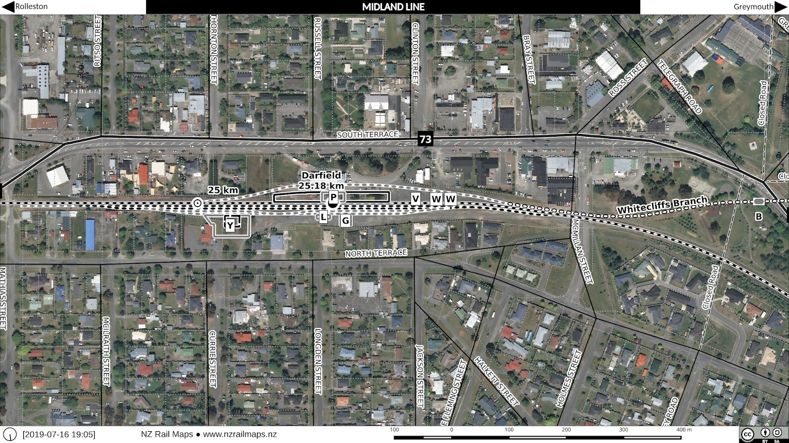
Today we have a set of maps of the stations on the Whitecliffs Branch, including the junction station, Darfield.


Darfield 2015/1970


Hawkins, 2.94 miles along the branch, and it seems one of the few with a regular size goods shed. 2015/1958.


Homebush 2015/1943. The two largest bridges still have superstructure in place, with the one that crosses a river substantially intact.


Coalgate 2015/1943.


Glentunnel 2015/1943.

 South Malvern & Whitecliffs 2015/1943.

 South Malvern 1943 & 2015.

 Whitecliffs turning triangle 1965 & 2015. The triangle is not visible in the 1943 aerial photo, so it possibly may not have been installed at that time.

Whitecliffs 1943 & 2015.