Showing posts with label Main South Line. Show all posts

Thursday, 19 December 2019

Project Diary 2019-12-19: Greater Christchurch Maps Update

In the last few weeks our research has continued of Greater Christchurch maps, branching out into looking into railway housing in Heathcote and Lyttelton. The development of railway housing in large cities is naturally very different from small towns, as these two examples show. We plan also to take a closer look at railway housing in Addington, but not in any other part of Greater Christchurch except where it is within a station precinct.

The research has come to a pause for now due to the holiday season, but we intend to take a few weeks' break even when Archives reopens in the first week of January and probably catch up on some other areas of the maps project (i.e. some areas outside Greater Christchurch). There are only a few stations' worth of files to look through within the GC area, perhaps only at most two more months of research. The maps themselves haven't progressed much recently, but the break period will be used to get progress in that area as well.

Monday, 2 December 2019

Heathcote Pumping Station Siding & Ferrymead Railway Siding [2]

Following on from last month's post about the Heathcote Pumping Station siding, here is an updated map showing the Heathcote Expressway cycleway that is expected to be built along this corridor within the near future. It will cross over the Ferrymead Railway siding and then follow the Main South Line corridor to Truscotts Road.


Railway Housing in Greater Christchurch [2A]: Lyttelton 1

Following on from the discussion in the last article about railway housing around Lyttelton, here are some aerial photos with labelling showing where some of the railway housing was located there.

This is preliminary as more research is needed to identify all of the railway properties across Lyttelton as well as in this specific area. However, with the knowledge obtained to date, some of the housing in this area can be confirmed as being railway owned in the 1960s.

 The above, black and white aerial photo dates from 1973, while the below colour aerial is from 2015. We believe most if not all of the housing in the area enclosed by Brenchley Road, College Road and Crossland Terrace, was part of a railway settlement in Lyttelton. Marked so far are the four properties that still exist in some form today.

Friday, 29 November 2019

Railway Housing in Greater Christchurch [1]: Introduction

As we all know, when NZR developed their network, staffing requirements especially in remote locations often required housing to be provided. There are a number of townships in NZ where the amount of railway staff housing was significant compared to the overall community, including several railway towns - Otira on the Midland Line being one of the best known examples and one of the few that is still substantially unaltered today.

In the course of the Greater Christchurch research several housing settlements have come to light around the city, some of which have long gone and others which still exist in some form, however in general Kiwirail does not have any houses of its own these days and only occasionally leases properties as needed such as at Otira. At a major station there would generally be a stationmaster's house which was separate from most other housing, the latter tending to be a row of houses close together, and generally without driveways or garages although a small shed was commonly seen on the majority of sections.

As we generally know, NZR housing became a major focus around 100 years ago to the extent that a housing factory was built at Frankton (the buildings still exist in some form) and prefabricated standarised designs were churned out for a number of years afterwards. Hence it becomes possible to identify ex-Railway houses by sight in some areas because of the characteristic appearance. Wherever possible, Railway housing settlements were often placed at the edges of railway yards.

We haven't specifically researched Railway housing in the Greater Christchurch area just yet but intend to do so as it is becoming a topic of interest and the map key does include a code for marking houses which has been undertaken on other maps we have developed, most notably the Otago Central line, so having stumbled across a number of files specifically related to housing in our research currently on Lyttelton, we now intend to research the housing more intensively in order to document it as part of the maps.

Our research some weeks ago on Christchurch Station, for example, documented that a house for the stationmaster may have been provided somewhere in the area in the early 20th century, but it was not too long before NZR started to pay their stationmasters allowances to live in their own houses elsewhere. For example, paying the telephone connection and monthly fees for the Christchurch stationmaster was undertaken for many years in recognition that they would be expected to be available on-call most of the time when not actually working.

Housing at Lyttelton appears to have been located all over the township rather than being clustered close to the station. So far we have uncovered that NZR owned houses as high up as College Road and Brenchley Road (these locations are near the northmost limits of housing development on the eastern side of the township). As our aerial photos at the moment don't go that high, we may have to extend them if possible in order to show the housing on maps.

Heathcote is an interesting place to investigate as well because a housing development was undertaken c. 1960 at Railway Terrace, between the upper section of Martindales Road, Port Hills Road and the Tunnel Road. At this stage we can only speculate that the intention was to provide for a number of staff housing needs in the general area rather than specifically for Heathcote, as it is evident on the map that there were approximately 20 houses constructed, and Heathcote has never been a major station that would have required a significant number of staff - by that stage probably only a stationmaster and/or signalman. Since NZR sold the housing, some of the sections have been redeveloped but there are still some of the staff houses in place. Further research has yet to be completed on this settlement and the other NZR housing that is known to exist around Heathcote.

Then-new housing development at Heathcote in 1961. Martindales Road has been extended to give access to the tunnel road formation during the construction of the Lyttelton Road Tunnel project.

View of some of the wider area in 1970, including a water reservoir on the hillside above that no longer exists today.

Same view as the first map but taken 2015, the settlement has changed much but some of the houses are essentially the same.

No survey of railway housing in Greater Christchurch would be complete without looking at the settlements around Addington Railway Workshops. At this stage we know little about this housing except that due to the extensive changes in the transport landscape that have taken place in Addington over the past 30 years, even some of the streets these houses were in have disappeared.

The first area that may have been a railway settlement at Addington is directly north of the Shops site in Lowe Street. Earlier aerial photos show this was almost all in housing, whereas today there is hardly anything left due to it becoming mostly commercial and light industrial in nature.

Addington in 1940. The area that may have been a railway housing settlement is bounded by Lowe Street, Tyne Street and what later became Blenheim Road (known as Alliance Street at the time). There already seems to have been some industrial development in Pope Street in the area opposite the saleyards that later became the NZR Publicity and Advertising premises.

 The same area of Addington in 2015, some 75 years later. Tower Junction occupies the Shops site, and the housing has almost completely disappeared from view. In fact there was just one of the old houses in a run down condition which appears to the left and slightly below the 0.5 km peg. But the latest imagery from Canterbury Maps (below) shows it too has gone recently.

The other main area of Railway housing we are aware of in Addington to date is directly to the west of the Shops. This was never huge - there may have been only about 20 houses there at its peak - but the streets themselves were removed completely when Tower Junction was developed.

The NZR housing settlement in Margaret Street, Levin Street and Bell Street, as seen in 1940. There were still some houses there in the 1980s although parts of the land by that stage were being used for Shops purposes such as carparking. Clarence Street at that time was the major through route of the area, with a level crossing over the Main South Line just west of the present passenger station.

The same area much altered in 2015. Whiteleigh Avenue has become the major roading route with a new level crossing and Clarence Street is now closed off and (as Troup Drive) ends at the entrance to the present Christchurch Railway Station (Addington).

Sunday, 17 November 2019

Lyttelton: Then and Now

Here is a much anticipated post about Lyttelton. However, it is just a brief comparison over 50 years. More in-depth of Lyttelton will follow as soon as we have completed archival research in a few weeks' time.

 Above: Lyttelton Port 1967. Below: Lyttelton Port 2015.

Saturday, 16 November 2019

Project Diary 2019-11-15: Greater Christchurch Maps Key Milestone


We are pleased to announce a key milestone has been reached in the Greater Christchurch maps we are producing as part of the NZ Rail Maps project. We have now completed the historic aerial photo mosaic projects for all of Greater Christchurch, that is, the following four sections of railway:
  • Eastward: Main South Line from Christchurch to Lyttelton
  • Westward: Main South Line from Christchurch to Rolleston
  • Southward: Hornby Line from Hornby to Lincoln
  • Northward: Main North Line from Addington to Rangiora
This means the remaining steps needed to produce the actual maps for Greater Christchurch are:
  • Extract map tiles from the mosaic projects for GIS use 
  • Complete basic historical research for every station and siding in the Greater Christchurch area
  • Draw and label the maps for every location.
The extraction step is a slow one because of the use of multiple generations of historical aerial photography in the mosaic projects - the same reason why it has taken so long to produce those mosaics in the first place. In addition, once the resulting tiles have been imported into the GIS, it is common for mistakes to be detected at this stage, requiring more work to rectify.

The historical research stage is also slow because of the number of files that need to be consulted. At this stage we have been researching up to 50 files in a typical week over the past 3 months, which in total has been in actuality 500 files to date. We estimate it will take another 6 weeks of work to complete this but there may not be more than 200 actual files left to look at.

After obtaining the various diagrams that we have copied as part of the historical research, some of these will need to be imported into map mosaics where they are the only source of information for a particular historical feature. An example is the pumping station siding at 2.81 miles on the MSL that was the subject of a recent post. Since this did not appear on an aerial photo, the copied drawing was added into the existing aerial photo mosaic and another set of tiles (only 2 in this case) dated 1924 were produced for the GIS in order to be able to draw the maps that accompanied the blog post. There is likely to be more of this needed, so the mosaics will have to be added to with the diagrams that have been copied. However, unlike the aerial photos that have been used in the projects to date, most of these diagrams only cover small areas and therefore don't take very long to be added in. So that will not in actuality cause much additional delay, as most of the diagrams we have copied in actuality are just for labelling features that we can already see on aerial photos.

Then finally the maps get drawn and labelled. How much work is needed for each yard depends on how big the yard was. This in turn informs the complexity of the task. In the past we have gone to great lengths to document as much as possible historical changes visible on different generations of aerial photography. Our focus has changed with Retrolens because of being able to get the NZR yard and corridor surveys that are not available on our previous main source for the region, which was Canterbury Maps. This means we have changed focus into having really only one or two complete historical layers for a yard or section, which will be a yard survey if there was one, and a corridor survey if there was one that shows significant changes from the yard survey. There are a very small number of yards that have had two NZR surveys, and the corridor surveys are additional to these. In the case of a small number of yards there is no yard survey (Heathcote for example) and we are relying on other historical surveys that are available of the general area. For some stations these will be highway surveys if the yard was alongside State Highway 1 or another highway corridor.

Previously we would go to great lengths to try to document which parts of a yard in the modern era were based on historical features visible in the yard survey that might have been done 40 or 50 years ago. However as you can imagine this requires a lot of work, not the least because it is difficult to exactly align the historical aerial photos to modern ones, and because in the case of some yards (Lyttelton, Middleton and a few others that come to mind as examples) they have changed so much that there has been major track realignment. So right now the focus is on drawing every track in the historical layout as a "former" or "closed" track and then drawing the tracks again as "current" or "open" on the contemporary aerial background, and not bothering trying to work out which bits are common to both. Just that we will use the filtering capabilities built into the GIS to display the appropriate generation of track and structures etc with the aerial photo generation that is applicable.

As we have noted in previous posts the actual map drawing is the furtherest behind at the moment as we have focused most of our time in the last few months on the mosaics and research work. This has been changed this week with the completion of the mosaics and even though research is not completed, we are currently progressing as much map work as possible, with Lyttelton and Heathcote progressing well at present. There has just been a post about part of Heathcote and our next post will be about Lyttelton. However we still have to do historical research for Lyttelton so the maps posted in the next post will be necessarily limited until we can find out more historical information about the general layout of Lyttelton. On the other hand it is possible to push ahead with Heathcote to full completion because we have done most of the research on that yard although there is still a small amount, maybe one day's worth, to be carried out.

So expect to see a lot more posts about specific yards and locations in Greater Christchurch in the coming weeks. Once that is done, then the overall project work will shift back to the rest of NZ as detailed in other posts in the last few months with the total project schedule. We can then expect to see the volumes produced for all of the other maps for the whole country.

Wednesday, 13 November 2019

Heathcote Pumping Station Siding & Ferrymead Railway Siding [1]

Recent research has turned up the existence of a siding to the pumping station in Scruttons Road, which is just behind Ferrymead Heritage Park. In fact it is right where the Ferrymead Railway's siding goes off the Main South Line.

The date of when the siding was established is unclear, but the file starts at 1899 when a five year term of renewal was being offered. The pumping station was owned by Lyttelton Borough Council as part of the town water supply. The pipeline itself, as is well known, runs through the Lyttelton railway tunnel, and at times has been cut by train derailments, for example when a locomotive has gone through the safety siding at Heathcote.

The siding came off the MSL Down Main at 2 miles 64 chains 58 links (2.81 decimal miles) which corresponds to just over 4.5 km in metric measurements. Since the actual location is closer to 5 km than 4.5, the zero peg at Lyttelton must have been in a different place in the late 19th century or early 20th century than it is today. This is further confirmed by the position of Heathcote Station from other research, at just over 2 miles (3.2 km), compared with the modern metric measurement of 3.6 km for Heathcote. Maybe the zero peg was on one of the Lyttelton wharves - we'll cover this idea in more detail in our first posting about Lyttelton. At the moment we have decided to finish drawing all of the very extensive Lyttelton trackwork onto the maps before doing our postings. This is a big task - there must have been over 100 sets of points at Lyttelton, with three way turnouts, crossovers and double slips galore, and maintenance of these would have been a big challenge for the track staff in the area.

Maintenance was also the reason why the pumping station siding was taken out. In the mid 1930s preparations were under way to introduce automatic signalling on the Main South Line between Christchurch and Heathcote. This would have required a switchlock installation at the pumping station siding. As the siding was by that stage little used, it was agreed in 1934 that the siding would be removed.

The area was then largely undisturbed for another 30 years until the Ferrymead Railway began to develop in the mid 1960s. This eventually led to the extension of the Railway to a siding that would be able to join to the main line to allow for the transfer of rolling stock. On 1 October 1978 this siding was used for the very first time. A temporary connection was made to the Down Main by cutting and slewing the track for a few hours, and a number of items were transferred, including several steam engines, and Vulcan railcar RM 56, which was the first of the three railcars to arrive at Ferrymead. (The Ferrymead Railway's recent celebration of 40 years of Vulcan Railcars was a year behind schedule)

There were numerous rolling stock transfers via this temporary connection on multiple occasions between 1978 and 1988. On at least one occasion a wagon was transferred by the use of cranes to do a lift from the main line to the siding. The actual connection of track was much more common and some of the times it was used include in 1979 when the other two Vulcan railcars were transferred, late 1983 (September?) when the Diesel Traction Group took delivery of DG 772 and ED 103 was also delivered to the Ferrymead Railway, and in November 1987 when the DTG's two DEs were delivered along with EW 1806, some wagons, and F 13 returning from a trip to Oamaru. However it is notable that many other locomotives at Ferrymead were moved in and out of the site by road, and this included the two English Electric DC locomotives EC 7 and EO 3 which were taken by road and stored alongside the tram barn until the mid 1970s when they were moved onto rail at the Ferrymead end, most of the smaller steam locomotives including C 864 and WD 357 that arrived in the 1960s and early to mid 1970s, as well as practically all of the carriages and wagons that have arrived before the permanent connection was put in.

With the impending Rail 125 celebrations in 1988 a regular connection with a turnout was first installed at that time, and as we all know this saw many locomotives and rolling stock vehicles moved out of Ferrymead for various events including the Diesel Traction Group's locomotives running a mainline excursion to Springfield, carriage A 516 and van F 372 that ran behind W 192 on a series of night trips to Kaiapoi, and the items used in the Cavalcade in the Christchurch railway yard. But the most regular use of the siding at Rail 125 was to run the steam shuttles from Christchurch to Ferrymead, which returned via Lyttelton due to the operational requirements imposed by the siding configuration. These were operated numerous times every single day of the festival with C 864. This was also the first time that any NZR locomotives actually ran on the Ferrymead Railway, as several shunts hauled by DJ locomotives were brought into the Moorhouse yard to move all the items needed for the Cavalcade to Linwood Loco.

After the completion of Rail 125, there was a need to decide whether to make what was a temporary installation, permanent, with proper signalling (principally a switchlock and trap points) to conform with normal NZR standards for private sidings. The cost of doing this was partly paid for by Ferrymead Railway, with more than 50% of it covered by Christchurch City Council on the basis that further opportunities for steam shuttle operations from Ferrymead would be beneficial for tourism in the city. However the potential of such operations has never been realised beyond the 1990 Steam and Rail Festival held at Ferrymead, which to the best of my knowledge is the last time that any such steam shuttle has run, and was a bit of a fizzer because C 864 ran a hotbox on a night service and hasn't operated since. A combination of factors have made it much more difficult to have these types of services running on the main line, including the closure of Christchurch Station and the altered track layout at the current Addington passenger station, and greatly increased mainline running standards and costs that have shut down Ferrymead Railway's local train running that was a feature of the mid-late 1980s Christchurch railway scene. So the siding doesn't get as much use and we have only very occasionally seen any kind of public passenger service come into Ferrymead, such as at Rail 150 when a Silver Fern railcar ran services in from Lyttelton. But it remains quite useful when the Diesel Traction Group want to send one of their locomotives out as they have done more recently with DE 1429 going to Weka Pass and DI 1102 going to Dunedin, or with the National Railway Museum's rolling stock arriving.

Due to the arrangement of the siding connection, rolling stock leaving Ferrymead must either run to Heathcote and then cross over to the Up Main to get to Christchurch, or run wrong-line to Woolston and cross over there. This requires special operating procedures as the line is signalled for unidirectional operation in the Down direction only, which means the section of the line has to be blocked against other Down trains until the locomotive reaches Woolston, and the crossing alarms at Scruttons Road and Chapmans Road will not operate until the train actually reaches the crossing and therefore have to be approached and crossed at 10 km/h and only after the bells and lights have been operating for long enough to allow road vehicles to safely clear the crossing. Rolling stock arriving at Ferrymead must run to Woolston on the correct line (regardless of which direction it is coming from) and then run into the siding from Woolston on the Down Main. In addition, permission must be obtained from Train Control to open the switchlock off the Down Main at the entrance to the siding. In accordance with standard siding design, a set of trap points and a trap points indicator are fitted to the siding and interlocked with the main line points, to guard against rolling stock running away from Ferrymead and endangering the main line.

This map using the 1985 NZR corridor survey shows the pumping station complex at that time.
A view in colour using lower resolution (0.75 metre) photography shot for Ecan in the 2000s.
This aerial photo was taken a couple of days after the February 2011 Lyttelton earthquake and shows the pumping station buildings completely gone as a result of damage sustained in the quakes.


And here is what the site looked like in 2015, which is practically the same today. The pumping station has been replaced with a new one with different buildings.

Saturday, 2 November 2019

Project Diary 2019-11-02: Christchurch Maps

Our first blog post for November. 

Map production this week has been limited to a complex fix for a problem discovered in the Heathcote-Ferrymead maps for 1985. Trying to align two different rail lines in four places simultaneously can be very complex. Cutting the Main South Line out through the back of Ferrymead is a partial solution. The rest of the fix was to cut the aerial photo covering Ferrymead in half and align the two halves separately. Due to the amount of work needed, no action has been taken with other generations, although most of them satisfactory as they are. Most of the intention in having all the generations is not to document Heathcote, but more to do with the early history of Ferrymead.

Research this week has taken in Addington Station, including all of the private sidings, Templeton Station, and Papanui Station.

Saturday, 26 October 2019

Project DIary 2019-10-26: Christchurch Maps

It's been another busy week of gathering research information and a lot of work pulling out map tiles. As noted in previous posts, we spend a lot of time each week, currently around 6 hours, researching all the stations in the Greater Christchurch area. This will involve viewing around 50 files a week and copying mainly track diagrams from them in order to be able to label everything on the maps properly. We have spent most of the time actually just gathering the information and very little lately has been put into maps because the process of creating the historic mosaics and getting map tiles out of them is relatively time intensive. 

So at the moment things appear to progress slowly while the main focus is in these phases of gathering information and investing a lot of work into creating the historical map background images to show the various locations around the Greater Christchurch railway network. This week's research had a look at Linwood Station which was a passenger station on the MSL between Christchurch and Lyttelton. It was located between Linwood Loco Depot and the Wilsons Road crossing and it served exclusively suburban passenger traffic. Like the other suburban stations on the "Port Line", Linwood closed in the early 1970s when the commuter trains to Lyttelton ceased operating, and there is practically no trace of it to be found today. However, NZ Railways Corporation still owns the entire Linwood site that it occupied until the mid 2010s and which is now leased to a number of entities. 

We also took a look at the early history of Linwood Loco, but aren't specifically interested in the entire history of that site, and haven't yet examined all of the records relating specifically to Linwood Loco. We also took a look at Opawa Station, which was the next stop up the line from Linwood and was also passenger specific. Ashley is another small station near Rangiora on the Main North Line and it was between those two stations that a couple of minor realignments of the MNL took place in the 1960s and 1970s relating to the replacement of two bridges, one of which is a major structure crossing the Ashley River. Ashley Station closed in the early 1960s partly as a consequence of the construction of the Ashley Bridge deviation but a siding is still in place for the nearby Canterbury Timber Products factory although disused for some years. Addington Station and also the Way and Works "Plant Zone" and the Signals Depot have been researched and we are currently looking at the numerous private sidings around Addington, including the NZ International Exhibition of 1906 siding which was laid from Riccarton Station across Hagley Park, and the lengthy Fletchers Siding also known as "The Alley" which served many industries and ran from Addington to nearly Riccarton Road.

Map tile production this week has taken in Heathcote and Ferrymead, so that we now have full sets of tiles covering 1940, 1950, 1961, 1970, 1973, 1976, 1985, 1995, 2000, and we also have the Linz aerial coverage for the 2000s, 2015 and some additional Canterbury Maps coverage for updating parts of Heathcote and Ferrymead to 2019. Normally for a smaller station like Heathcote we wouldn't cover such a large number of generations, however the interest for the widest range of coverage is more geared to Ferrymead, which was in significant development from the mid 1960s to the mid 1980s. Now having these full sets of maps will enable work to go ahead particularly with a high priority for Ferrymead; given that we already recently got full map sets for Lyttelton but have done very little with them so far, our actual resources (time) for map drawing itself are a bit scarce at the moment.

A partially completed map of the Ferrymead Railway Moorhouse Village site in relation to the Main South Line in 2019.

The Ferrymead site in 1961, when it was still a dairy farm.

Thursday, 3 October 2019

Project Diary 2019-10-03: Christchurch Maps

Well here's another update, and promises, promises, promises.... the last week has slowed things down a bit due to having to deal with other issues, but we are back up to speed now. Plus there have been more than a few issues with Gimp that caused crashes, meaning having to go back and redo stuff and try to find out what wouldn't crash.

The reason there are issues with Gimp and needing a lot of hardware resources (a PC with 32 GB of RAM and a 200 GB SSD swap partition to use for the tile cache), is our preference to use the highest resolution imagery we can. For base imagery that is a resolution of 0.075 metres per pixel (i.e. 7.5 centimetres) and everything snowballs from there. Take for example Lyttelton. We could just do the main railyard but have chosen to cover all the areas where tracks went to, and that means a canvas of 12 tiles wide and 4 tiles high. That translates into a size in pixels of 57600 by 28800, or 1.6 billion pixels total. The highest resolution imagery from Retrolens (usually around 1:4300 scale but occasionally 1:3400) fits in well with that base resolution. By the time we've added in a few eras of historical imagery (from 1940 to 2000 generally) then the result, in this case, is a file size of 21 GiB. It's only since Gimp 2.10 came out that it's been possible for it to handle files greater than 4 GiB in size, which is a real blessing because otherwise multiple files would be needed which would be very inefficient and time consuming. 

We started out some of these Gimp projects covering multiple stations but then as more layers were added (we use a rule of thumb that no project will have more than 100 layers) some of these projects grew too big and had to be split into multiple files. That happened in the case of Lyttelton, which used to have Heathcote along for the ride, which is what was happening earlier this week when everything kept crashing because the system or Gimp hit some sort of limit. Heathcote is a big area to cover because it takes in Ferrymead, so the result was a lot of area to cover and eventually the need to split the files, which we can now recognise because the current version of the Heathcote file is 30 GiB and that is the upper limit of file size we're prepared to work with, from experience. With a file that size it takes ages to load into Gimp, the system will easily use half the total tile cache just to bring it up with no edits, and it can take three hours to save (and Gimp can still crash partway through the save if the file is too big and lose everything). So you can see we are working with some real limits.

The resource issues for doing these highest quality images is the key issue that affects the kind of coverage we do of stations around the country. Christchurch is a particular exception that is going to be the highest quality for all of Greater Christchurch, across multiple generations, and backed up by research as well. That simply can't be justified across NZ, and only major yards will get done to that level. Most sites will be done with just the NZR survey, an example being Bluff that was recently draw up, it was done to high quality but only one generation of historical images. With corridor surveys we can cover the smaller stations as well, but if we can't get coverage of them when they were open, there won't be any. Before we dropped the Midland Line coverage to focus on the Greater Christchurch stuff, we had covered just about all the stations to Kotuku with corridor surveys plus the major stations and some research as well. The same will go through for the MNL and MSL eventually as far as we can get to.

Anyway back onto Greater Christchurch, we only have the MNL from Riccarton through to Ashley to complete. The tiles for the rest will start to get spat out as quickly as we can from here, because map drawing is way behind and really needs to be pushed along as quickly as possible now. So all that MSL stuff will be pushed out as map tiles and then be drawn alongside finishing that stretch of MNL as quickly as possible.

Tuesday, 24 September 2019

Project Diary 2019-09-24: Main South Line

The southern most section of the Main South Line, from Templeton to Burnham, for the Greater Christchurch maps, has been completed in a mosaic form, with eras of historical maps varying from the early 1940s through to the year 2000. We had only intended to go as far as Rolleston, but as Burnham is just south of there and did have its own railway siding into the army camp, it was decided there was no harm in including that stationb. Apart from Templeton, Rolleston and Burnham, this mosaic project also includes Weedons and Weedons Air Base Siding. The air base site was opened sometime in the 1940s and closed roughly 60 years later, but the last remaining storage hangar was only removed quite recently.

The current Linz aerial photos we have of Rolleston are too old to show the Port of Lyttelton inland port site details, and since Canterbury Maps have much more recent ones, we will endeavour to find some way we can use the more recent imagery.

Mosaics are mostly completed for the rest of the Main South Line but there is still a bit of work to be done on the Lyttelton-Heathcote section. The Hornby Industrial Line section to Lincoln has been mosaiced and we are currently doing research on this section from Archives New Zealand. What has still to be carried out is the overlaps between all of the different mosaic projects that are of continuous sections of the rail corridor. In general the MSL corridor is mapped as a continuous section from Heathcote to Islington, and the Hornby Industrial Line from Hornby (MSL junction) to Lincoln. For  practical purposes these continuous sections are divided into a number of different Gimp project files with small overlaps, usually a single column of Linz base tiles. This makes it possible to easily copy overlapping layers between Gimp projects so that the other layers in a project can be lined up with the overlaps; this means that when the tiles are all viewed together in Qgis, everything lines up nicely across all the different sections. In Qgis the tiles are grouped by station, so that the different eras of a station's aerial photos can be turned on or off as the base imagery for each section of the maps. 

The local government elections in Christchurch are now underway and we await the results with interest. We believe that greater Government intervention in Christchurch is required to reorganise the planning focus of the city to designate the key rail corridors for their importance to urban development to get a full public transport focus for commuter rail in the city. The new city council will need to focus more on working with other bodies cooperatively and drop the previous council's efforts to take over the public transport system which has been an unneeded distraction. Public transport should continue to be regionally organised with increased powers given to the regional council. The Government has been content to date to leave the business cases for commuter rail to be developed by the local authorities which is really just giving a nod to their fellow Labour Party members in those authorities rather than actually indicating a genuine intention to bring about the implementation of such a service.

Thursday, 12 September 2019

Project Diary 2019-09-12: Hornby Industrial Line

As we continue assembling maps for Christchurch Transport Blog use, currently we have shifted to the Hornby Industrial Line, which is historically the section of the former Southbridge Branch from Hornby to Lincoln. It was designated as such in July 1962 after the branch was closed beyond Lincoln. In December 1967, the section of the Hornby Industrial Line between Prebbleton and Lincoln was closed. Subsequently, the section from around 3 km to Prebbleton was closed, although most of the track is still in place as far as Springs Road, except for the section now crossed by the Christchurch Southern Motorway, SH76. The Prebbleton overbridge was demolished in 1997, and all of the corridor south of Springs Road has been built over. The section from south of SH76 to Springs Road has been reused for a rail trail alongside the mothballed track. 

From time to time the idea is floated that the line could be reopened to Lincoln and if this were to take place, the route beyond Prebbleton would have to be changed due to the reuse of the corridor, including new station sites.

The maps below show some of the sidings which can be traced in the 2015 aerial photography. We know that many more will be visible on the historical map mosaic tiles when they are finished.

Around 1 km, with a siding visible across the site of a demolished building.
Around  1.5 km, at least three sidings are still partly in place.
Quite a notable siding around 2 km.  These premises are currently occupied by Pengelly Transport and may possibly have been used by Toll Freight at one stage.
The lengthy Watties-Tegel siding at around 2.5 km. This was the last siding used on the line. With the closing of this siding, there is no traffic currently moving on the line.
United Empire Box Co Ltd (known today as UEB) seen above in 1973 with a siding. There is no obvious trace on the aerial photos of this siding today.
UEB in 2015.
Prebbleton yard seen in 2012.

Saturday, 7 September 2019

Project Diary 2019-09-07

As some will know, this week CHAT Club released their "MaRTI proposal", which suggests the Middleton rail yards could be turned into a housing development. A couple of posts about it have appeared on Christchurch Transport Blog, but the indepth analysis hasn't been done until the historical maps of Middleton are ready. As per usual this has taken longer than expected but right now they are about to be saved in their final form.

The Gimp project covering this part of the MSL takes in from Middleton to Sockburn in order to keep the project at a reasonable size but it still has nearly 80 layers and a file size of just over 30 GiB. As per usual we start with 1940 as the first era covered, then 1950 and 1961. These three eras in particular are pretty much what can be found to cover any part of the railway landscape in Christchurch, but they are not rail specific. They vary up to about 1:16,700 scale. What is rail specific for this particular part of the MSL rail corridor are the NZR station surveys, which are in particular for Middleton in 1967, Hornby in 1972, Middleton again in 1975 and Sockburn in 1980. The actual areas covered extend outside those named stations. Typically the station surveys have a scale of around 1:4300.

Then we have the MSL corridor survey starting at Lyttelton and heading to Ashburton in this case, and it dates from 1984. Scale for these corridor surveys is usually 1:5500. To finish off we have two more non-rail surveys which are again standardised over much of Christchurch, and they are from 1994, and the only colour one which is from 2000. These last two are at a scale of 1:50,000 and because they cover such a large area at that scale, they have to be trimmed down to covering only the base tiles that we actually use in order to avoid a lot of unnecessary pixels having to be saved in the file and blowing it up too big. To explain further, these are the only layers that cover the whole area of the project canvas in one single layer, and with a canvas that is only half filled, due to the shape of the base not being a nice and regular, we have to avoid covering areas of the canvas that aren't occupied by the base layers, because it just wastes file space unnecessarily and it can add up to a few extra GiB each time we save, which is a big deal.

Tuesday, 3 September 2019

Project Diary 2019-09-03

Chat Club, a group of transport professionals that has been running rail passenger workshops in Christchurch, proposed at a seminar on Monday evening that the Middleton rail yards could be closed down and relocated further west, to enable the land occupied to be redeveloped for medium density affordable housing (1600 homes approximately). About 50 people attended the presentation, including a number of candidates in the upcoming local elections.

There have been two articles in the "Press" so far:
The first one is the details of the proposal and the second one states that Kiwirail is not planning to move from the Middleton site.


At this stage it will be interesting to see where the proposals go as it will now have to be looked into further as an option if the Minister of Transport decides to investigate the idea. At the same time there are several other possible sites nearby, such as Addington Saleyards, Waltham freight yards and Linwood Loco Depot land which has either been undeveloped or minimally developed.

As for NZ Rail Maps we have historical maps of Middleton currently in the works and these will probably be posted on this site later this week or early next week. We also will have the historical maps of Linwood and Waltham available soon as well.

Saturday, 31 August 2019

Project Diary 2019-08-31

In today's update, we can report we have finally completed the historical map mosaics for the section of the Main South Line from Woolston to Waltham, after splitting the Gimp project into two parts to deal with persistent crashes caused by project file size. The last section to be added this morning was the historical coverage of the section for the year 2000, which is the most recent aerial photography available from Retrolens.

The historical eras covered in these mosaics of the Main South line are 1940s, 1950s, 1960s, 1970s, 1980s, 1990s and 2000s, with Linz aerial photography available after 2000. NZR official station surveys cover from Opawa to Waltham in 1970, Woolston in 1974, and Woolston to Waltham in 1981. NZR corridor survey is available from 1984, but only for Waltham; for some reason, an entire run (B) is missing from this survey. The rest of the coverage is general for Christchurch and of a lower quality and only the NZR surveys in general will be able to fill in the historical data for the section.

To back up the map data, this week we also have commenced three half-days of research at Christchurch Archives at the rate of one half-day per week for the Christchurch Station, which includes Waltham. We are prepared to carry out the more intensive scale of research just for Christchurch, and do not intend to spend any significant amount of time on the other stations, each of which would have less than one half-day spent on them. In each half-day session we would typically expect to view and copy content from around 40 files, and the time scale of one half-day per week is governed by limits on the rate at which Archives can produce and issue the files for our research. The main purpose of this research is to obtain additional map information about the locations and track layouts of sidings and time limitations mean we are not able to take in general historical research of the areas concerned, even though much of the information about Christchurch in the 1980s and 1990s is very interesting, being an era we lived through and had extensive knowledge of from a personal perspective.

At the moment our focus is going more into producing all of the mosaics as quickly as possible for Greater Christchurch, and less into drawing actual maps, and that is why we are publishing project diary updates lately rather than map coverage of the areas. This is driven by the needs of Christchurch Transport Blog for map tiles for project work, being a higher priority than NZ Rail Maps at present. Once all of the Greater Christchurch map tiles have been completed, then NZ Rail Maps can go back into map development around the country according to its existing goals. This of course also means the original project schedule for NZ Rail Maps that we outlined for 2019 will not be kept. We estimate at the moment it may take for the rest of 2019 to be able to complete the Christchurch Transport Blog map tiles, and therefore will have to rearrange our goals. 

This will mean the overall schedule for completing the bulk of the NZ Rail Maps project work for all of New Zealand will be altered. Against that, having increased resources has improved our efficiency considerably this week and will speed up the mosaic production.

Tile extraction for Woolston to Waltham will start early next week, so expect to see some actual historical mappables displayed in the next update. Mosaic production is shifting to the Middleton to Hornby section of the Main South Line, the Lyttelton to Heathcote section of the Main South Line (including Ferrymead) and the Bryndwr to Ashley section of the Main North Line which as far as possible will be worked on more or less simultaneously, as is now easier to achieve with the resourcing improvements.

Thursday, 29 August 2019

Project Diary 2019-08-29

This week work is still continuing on the historical map tiles for Waltham, Linwood, Opawa and Woolston. We have gained some additional resources this week to enable us to speed up the tile production work, so we are also simultaneously working on tile production for Middleton to Hornby section of the Main South Line, and the Bryndwr to Ashley section of the Main North Line. So the production of these tiles should be able to be sped up noticeably, as part of the reason for it being slow is the inherent slowness Gimp has when working with very large mosaic projects. Some of these cover a canvas surface having a working area of 3.5 billion pixels (3,500,000,000) and around 100 layers in total. The Woolston-Waltham project is now completed and tile extraction will be commencing and could be completed tomorrow but will probably have to be deferred for a couple of days due to other commitments, and we have had numerous Gimp crashes, so it has been slowed down a lot from what we expected last week.

The issue with a city like Christchurch or any main centre is you are looking at an entire section of a corridor, rather than a number of individual stations along it. Because there are sidings and stuff all the way along that corridor that you want to document, and that is certainly the case for the Main South Line from Woolston to Islington in particular, and on the Hornby Industrial Line as far as Prebbleton. It is not quite the same on the Main North Line which has historically much less industrial development. So that dictates Gimp projects that cover large areas. We could split these into multiple smaller projects but then there is too much problems with overlapping at the edges of these projects because those edges all have to line up when the tiles are put together in Qgis, and the historical aerial photos boundaries don't neatly end on a tile boundary. So a smaller number of larger projects is definitely the way to go, but we have had a few instances of having to split some of them up when they got too large. For example Addington to Ashley started off as one project, but then Addington and Riccarton got combined into another project with Christchurch and it ended up too large to put the rest of the MNL suburban area into it, so Bryndwr to Ashley is what it has ended up as. Same with Lyttelton to Waltham originally being one project that now has Lyttelton and Heathcote in one file and Woolston to Waltham in another. And so on. 

The extra resources mean the time Gimp wastes on saving large projects, which can actually take several hours to complete, can be used to work on another project at the same time. So in fact today we really were working on three at the same time at one stage because the first one was being saved. After completing the progress on the second one, it too was saved, and while that was happening, we worked on the third. Another time saving measure is to use Cubic interpolation for unified transforms instead of LoHalo. My hunch is that Cubic is a lot faster than LoHalo and makes very little difference to the quality of practically any layer we throw at it.

Thursday, 22 August 2019

Project Diary 2019-08-22

Since last week's diary report we have continued working on the maps for the Christchurch area. Putting together all the aerial photos can take a while to complete but we now have complete historical aerial photo tiles for Christchurch, Addington and Riccarton, and have started working on ones for Waltham, Linwood, Opawa and Woolston. These ones should be ready in a couple of days. Then after that we still have, as far as Greater Christchurch goes, to look at Lyttelton, Heathcote, Middleton, Sockburn, Hornby, Islington, Weedons and Rolleston on the MSL; Prebbleton and Lincoln on the Hornby Line; and Bryndwr, Papanui, Styx, Belfast, Chaneys, Stewarts Gully, Kainga, Kaiapoi, Flaxton, Southbrook and Rangiora on the MNL, to complete all of the stuff for GC.

Research has shifted to the GC area as well. After a break from the Midland Line work is starting with Christchurch Station which will take about 3 weeks to complete with over 100 files to view. The plan is to look at every station within the GC area in order to be able to fully detail the maps being drawn of the area.

Tuesday, 13 August 2019

Project Diary 2019-08-12

This week we have switched back to the Christchurch area maps due to the impeding local government elections. We are currently working with several candidates and preparing material in order to assist some of their campaigns, in association with Christchurch Transport Blog.

Because of this the Midland Line work has temporarily halted, although research at the local branch of Archives New Zealand has continued. We estimate approximately two more days of research at Archives will be sufficient to complete the Midland Line maps, but are unsure exactly when these maps will actually be ready.

We are taking the time to complete more of the historical maps of Christchurch as well as some of the other stuff we are doing so I have pulled up a number of Gimp projects and revised them as necessary to keep them within reasonable file sizes. For the Main North Line it is now split into one project that covers Addington and Riccarton along with Christchurch (from MSL) and a second one covering from Bryndwr to Ashley, previously it was all one project from Addington to Ashley. 

For the Main South Line we have Lyttelton to Heathcote including Ferrymead in a project, then from Woolston to Waltham, then from Middleton to Hornby, and then from Islington to Rolleston. The reason Christchurch was put in with Addington going north to Riccarton was because we had Addington in two projects, one for the MNL and one for the MSL, which was an unwarranted duplication.The one we haven't started on really is Hornby to Lincoln, and it's likely we will take Hornby out of the MSL Gimp projects at this point and put it into the one for the Hornby Industrial Line.

It's timely to comment briefly about maps of local government boundaries. Linz Data Services does not have this type of map in the list of layers that can be downloaded through their site on Koordinates. However, Statistics New Zealand, another Government department, does have them through its Datafinder site, http://datafinder.stats.govt.nz also hosted on Koordinates. As a result we have taken the opportunity to download six layers together: Maori Constituency 2019, Constituency 2019, Community Board 2019, Regional Council 2019, Territorial Authority 2019 and Ward 2019. This information is needed in order to discover the boundaries of each of the wards for the Regional Council elections and in so doing, be able to assist certain candidates in the wards of the transport related issues in their constituency.

Saturday, 10 August 2019

MSL Branches [17A]: Bluff Island Harbour


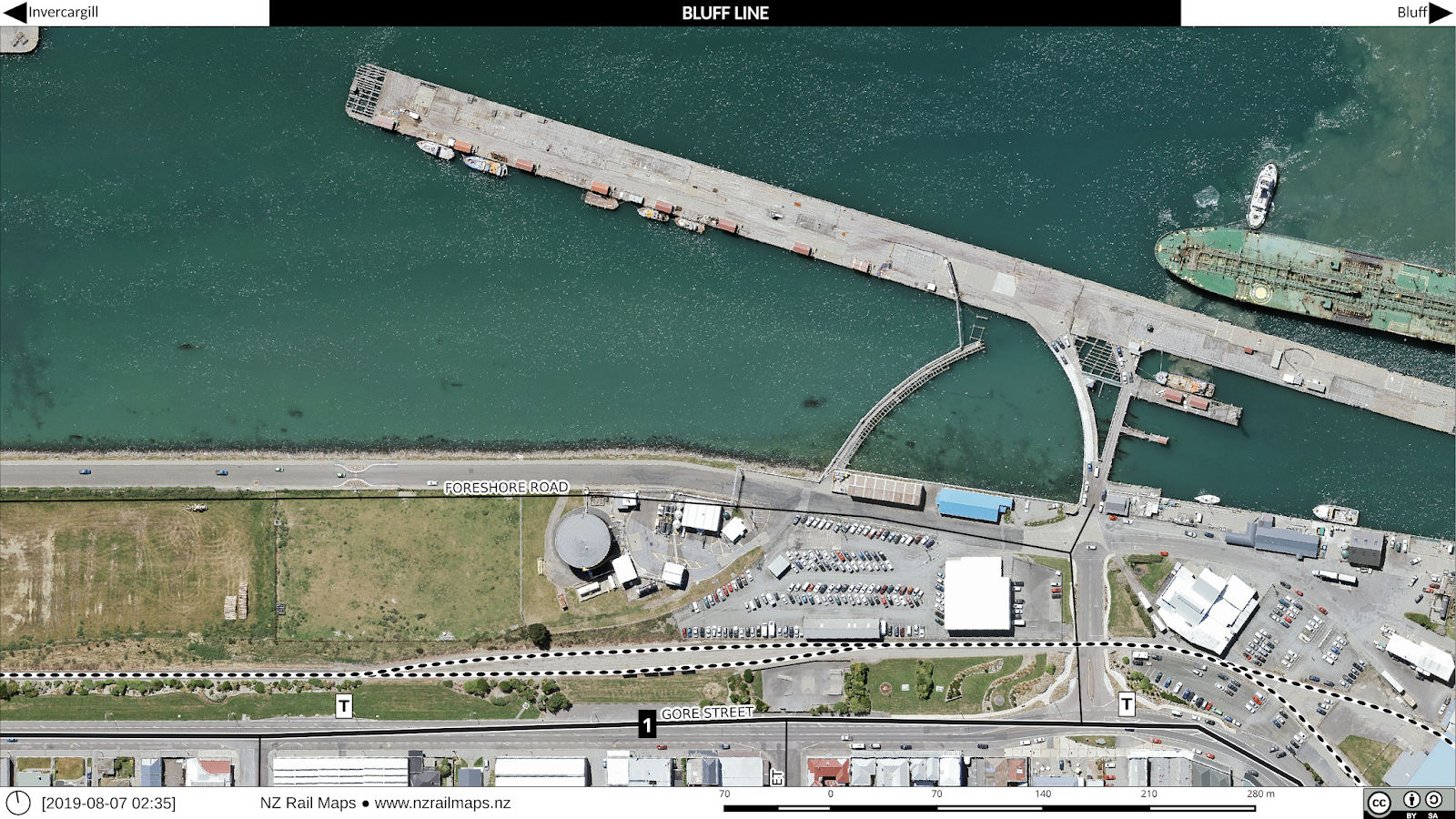
This week we took a little side trip to have a look at Bluff with the NZR aerial photos from 1972-3 covering the island harbour as well as the land based station yard. Like many ports, Bluff once had extensive shipside trackwork on the wharves that is no longer needed in this era of containerisation. As a result their rail network is much less extensive than formerly, aided by the shift to road transport and traffic being railed between Southland and other regions' ports to suit shipping patterns.


 Starting off with our usual pair of overview maps showing how things have changed over a 40-plus year period.

Our first maps are the island harbour. We don't know much about this structure, when it was built or for what purpose. Most ports have a series of wharves that jut out from and at right angles to, the shoreline. The "Island" is very unusual in NZ, and made for an interesting and unique rail layout. The westernmost tip as you can see was notable for the railway engine turning triangle, which is now gone.

Going east along the island, we get into one of the wharves, with a storage shed and attendant sidings. Ship-side sidings were very common on NZ wharves once, but have mostly disappeared since containerisation made it unnecessary to directly unload to railway wagons. Often times tracks are still in place on parts of wharves, but here there is just a single siding still connected and usable.

 More into the middle of the island is the main railway storage area. However the large yard with its multiple sidings has been largely reduced to the main line and a couple of tracks.

The south-eastern part of the island had several wharves along with their numerous tracks. Scissors crossings and other complex track structures such as double slips were commonly seen on wharves back in the day in order to fit as much track space as possible into a cramped layout. These days all but gone with just a couple of tracks across the whole area.

We can now have a look at the main railway station and yard at Bluff. The curve taking the main line across the bridge to the island harbour is to the left. Even in the 1970s there were few sidings in this area. The island section became the main line a long time ago and the Bluff township area a siding off it.

A little further east we come to the main railyards and some industrial sidings. These days practically everything is gone. 

Here we can see a shore-based wharf and a couple of industrial premises served by wagon turntables. These were once a popular way of getting into premises with a track and space saving layout, but fell from favour as longer and heavier wagons became more prevalent. The wharf was very interesting as there were no fewer than three separate tracks crossing between it and the shore, two of which can be seen in the black and white historical map. This was a necessity to connect up all the tracks in the tight space available, but these days, with no shipside tracks needed, the connecting lines and even some of the bridging has gone.

 Closeup views of the two sets of private sidings connected by wagon turntables. In the first photo we can see another track coming out of the front of one of the premises (far left) that appears to have been disconnected. The right hand premises in the same map is interesting as it was connected directly without a turntable.


Lastly we can see the end of the line where it went down to the tank farm and simply stopped adjacent to what was then the famed Fluteys Paua House. This area is known as "Bluff Township Siding".

Saturday, 22 June 2019

Project Diary 2019-06-22

This week progress has been slow but there has been headway in completing a set of mosaics for Christchurch along the Main South Line corridor. Another activity is in importing the old Google Earth maps that I have maintained from the beginning of the NZ Rail Maps project, into the Google Maps site. Another option I am investigating for these maps is the Open Historical Map site, which I have just found. At any rate, there will soon be a web based option of some form for placing the online map data that I currently have in KML files on my computer. These maps are very useful for quickly finding a rail route and stations and I use them all the time when looking up the Google Maps satellite pictures for an area. They are not actively maintained as part of NZ Rail Maps and are not recommended as a primary source of data.

I now have a second blog, Christchurch Transport Blog, and much of the recent work around Christchurch is more properly addressed by this blog, with the maps which appear on it being produced by the Christchurch-specific sub-project of NZ Rail Maps. Hence, from here on in, Christchurch Transport Blog will be talking in more depth about the Christchurch specific aspects of transport, that will take in a range of transport subjects about Christchurch. However, this blog and the NZ Rail Maps project will continue to talk about the rail-specific historical maps that are being produced as part of Christchurch Transport Blog. The CTB project also has its own Facebook group associated with its more specific segment of transport activism.

Something which is also of concern and deserves a greater focus is level crossing safety. There was this week a serious level crossing accident resulting in fatalities at Pongakawa, which is a small settlement along the East Coast Main Trunk railway between Te Puke and Edgecumbe. The full information on this accident is not yet available but we have to question the ability of local government roading authorities to be able to understand how to design safe level crossings because there are around the country numerous crossings of this particular design which have been shown to be hazardous. In this case the crossing concerned is regarded as dangerous by the local community but there has not been action taken to address their concerns. There are questions over Kiwirail's assessment criteria for what constitutes a hazardous crossing, the maintenance of crossings in safe working order, roading design, and funding for improving dangerous crossings.

Christchurch Transport Blog is going to have a post or two in the near future about crossing safety because concerns exists about some of the crossings in Christchurch and whether there is any incentive for either Kiwirail or CCC to address these concerns.