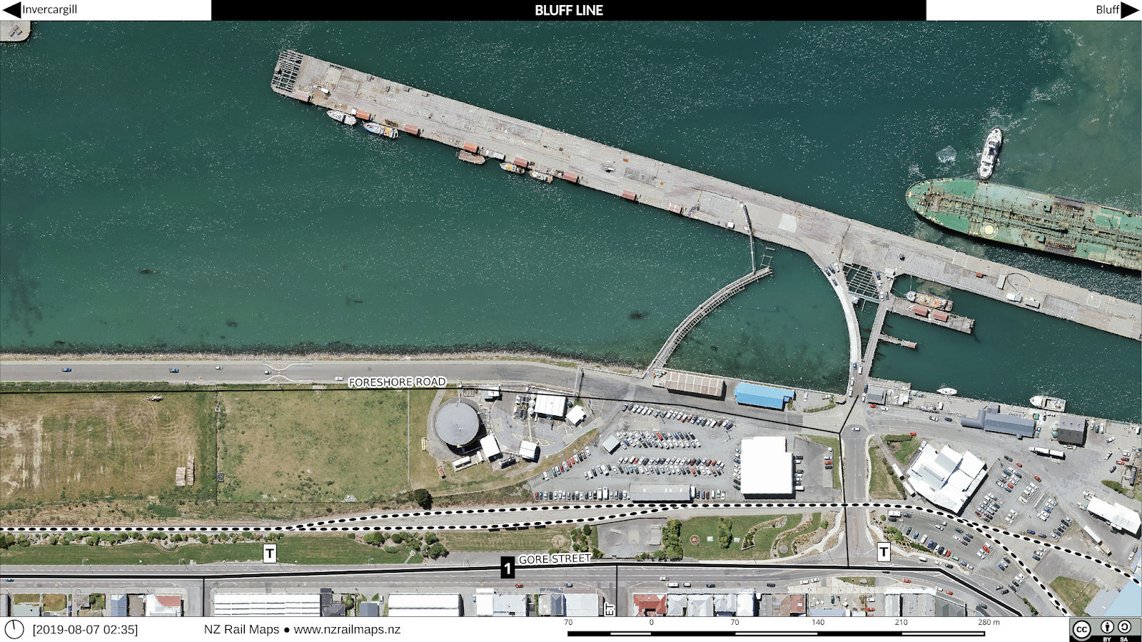
This week we took a little side trip to have a look at Bluff with the NZR aerial photos from 1972-3 covering the island harbour as well as the land based station yard. Like many ports, Bluff once had extensive shipside trackwork on the wharves that is no longer needed in this era of containerisation. As a result their rail network is much less extensive than formerly, aided by the shift to road transport and traffic being railed between Southland and other regions' ports to suit shipping patterns.
Starting off with our usual pair of overview maps showing how things have changed over a 40-plus year period.
Our first maps are the island harbour. We don't know much about this structure, when it was built or for what purpose. Most ports have a series of wharves that jut out from and at right angles to, the shoreline. The "Island" is very unusual in NZ, and made for an interesting and unique rail layout. The westernmost tip as you can see was notable for the railway engine turning triangle, which is now gone.
Going east along the island, we get into one of the wharves, with a storage shed and attendant sidings. Ship-side sidings were very common on NZ wharves once, but have mostly disappeared since containerisation made it unnecessary to directly unload to railway wagons. Often times tracks are still in place on parts of wharves, but here there is just a single siding still connected and usable.
More into the middle of the island is the main railway storage area. However the large yard with its multiple sidings has been largely reduced to the main line and a couple of tracks.
The south-eastern part of the island had several wharves along with their numerous tracks. Scissors crossings and other complex track structures such as double slips were commonly seen on wharves back in the day in order to fit as much track space as possible into a cramped layout. These days all but gone with just a couple of tracks across the whole area.
We can now have a look at the main railway station and yard at Bluff. The curve taking the main line across the bridge to the island harbour is to the left. Even in the 1970s there were few sidings in this area. The island section became the main line a long time ago and the Bluff township area a siding off it.
A little further east we come to the main railyards and some industrial sidings. These days practically everything is gone.
Here we can see a shore-based wharf and a couple of industrial premises served by wagon turntables. These were once a popular way of getting into premises with a track and space saving layout, but fell from favour as longer and heavier wagons became more prevalent. The wharf was very interesting as there were no fewer than three separate tracks crossing between it and the shore, two of which can be seen in the black and white historical map. This was a necessity to connect up all the tracks in the tight space available, but these days, with no shipside tracks needed, the connecting lines and even some of the bridging has gone.
Closeup views of the two sets of private sidings connected by wagon turntables. In the first photo we can see another track coming out of the front of one of the premises (far left) that appears to have been disconnected. The right hand premises in the same map is interesting as it was connected directly without a turntable.
Lastly we can see the end of the line where it went down to the tank farm and simply stopped adjacent to what was then the famed Fluteys Paua House. This area is known as "Bluff Township Siding".


