Showing posts with label Volume 2. Show all posts

Friday, 28 February 2020

NZ Rail Maps Project Development Report [2020D]

So here is our latest update on the overall NZ Rail Maps project. As we made clear earlier this year, we are working on completing all 12 volumes in 2020. That is an aspirational goal and for various reasons it's quite possible that goal won't be met. However it is worthwhile making a serious attempt to achieve it, even if we only get 10 of the 12 volumes actually completed by Christmas.

At the moment the schedule has slipped by about 10-14 days, based on when Volume 5 was finally published, and our anticipated schedule for Volume 6 which is currently in development. Looking at our last project development report published two weeks ago, we anticipated strong progress at that time. The first set of mosaics completed was for Wellington Yard, which was finished around the time of that report, or a couple of days later. These then sat for 10 days whilst the mosaics for the rest of the corridor were pushed ahead. This turned out to take somewhat longer than anticipated, naturally, and then when we finally produced some tiles for Wellington, bugs were found and have had to be fixed.

Because of the scale of the mosaics being somewhat more ambitious than expected, we have taken a bit longer than planned to churn these out, but progress is starting to happen and depending on how many bugs are found and have to be resolved, we anticipate completion of them will push into the middle of next week. We then have to update the map content as quickly as possible. On the other hand, like Volume 5, the actual content that is presented will be much more extensive than what we have published at any level before. For example we now have the full coverage of Hutt Shops and the Seaview industrial area on the Gracefield Branch, plus historical views of every station in the Hutt Valley, including multiple eras of Upper Hutt. We also now have coverage of Summit and Cross Creek when they were open, plus extra material for Maymorn, Kaitoke, Rimutaka Loop, Speedys Crossing , Featherston, Carterton and Masterton - as well as the Woodville junction that has already been completed in Volume 5.

The next question of course is what will follow Volume 6 and this is being eagerly anticipated already. That will be probably Volume 1, North Auckland, followed by Volume 3, ECMT. And whilst Volume 1 is relatively straightforward to complete with many mosaics recently produced, Volume 3 has very little. Because the ECMT is a very extensive corridor with numerous branches, and a few small areas have already been completed, but there would be a lot more needed. So maybe these two volumes together are a month each but Volume 1 will take less than a month and Volume 3, more. Volume 1 does not have any mosaics for Auckland and this is essential so this will add some work.

This leaves us Volume 4 and 2 to complete the North Island and these have been left as long as possible because significant chunks of Horizons Regional Council's territory and Taranaki does not yet have full Retrolens coverage because it has only been added since the start of this year. Volume 2 would be the most affected but we do have extensive coverage completed now of parts of Wellington, and Hamilton, but none of Auckland, and probably for the NIMT we would expect to have some of the major deviated areas covered as well as stations like Taihape and Taumarunui. For Volume 4 we would look to update Whanganui, which is already improving, and add New Plymouth, Stratford, any significant SOL station, and Okahukura.

So the schedule for the next four volumes after this is pretty well thought out and the work is going to keep being pretty intensive up to the middle of the year and probably a bit beyond.

Friday, 14 February 2020

NZ Rail Maps Project Development Report [2020C]

So a few days ago we completed Volume 5 of NZ Rail Maps. This is not the first time we have completed a volume in any format, but it is the first volume completed in the new online format. As previously noted, the maps in this photographic format are specifically designed to be used on handheld devices when actually travelling in the field, such as when riding on a train or travelling on adjacent roads.

Having had a few days to reflect, it is a big achievement. Volume 5 was issued in PDF format previously for the Napier-Gisborne section only, so it isn't so much a major achievement for Volume 5; it is much more of a major achievement for the whole project, being 1/12 of a methodical and planned megaproject of completing all of the maps in one year. 

When we planned this out, we didn't know how quickly we could do it, and therefore whether the maps would all be at basic level, with not very much of the historical aerial photos. There does seem to be, however, enough time to add some of the mosaic tiles for useful areas into the maps (at least for the stations that have official surveys) so we are adding as much of these as we can within time limits. In any case, it seems likely one or two volumes may take longer than planned, especially for example Volume 2 covering the NIMT, so a modest time overrun, say 2 months of next year, might be necessary. We will still be working to keep to time as much as possible with the rest of this year though.

Currently working is beginning on Volume 6, Wairarapa Line, with aerial mosaics of the Wellington end of the line currently being put together. This includes some work for Volume 2, NIMT. The first set of mosaics will cover Wellington yard and the Johnsonville Line for the NIMT, as well as Kaiwharawhara for both volumes, and Ngauranga for the WL. We had already done 1938 images of Wellington and 1944 of Johnsonville-Tawa a year or two back and to these we will add a 1941 view of Johnsonville station, 1971 views of the other stations on the Johnsonville Line, and stuff for Ngauranga from the 1960s and 1970s. Of Wellington itself, in addition to 1938, we will have an era for 1960, then 1988, and then 2000, the latter at quite a small scale but in colour as is 1988. There are a great many scans covering the Wellington railway yards at large scale in many cases (even for the highway surveys 1:3000 is not uncommon) which has given a lot of choice, and we already spent part of a day adding 1971 coverage of the yards and then dumped it the next day for the 1960 photos which were a motorway survey.

Once these are complete then the focus will be exclusively on the Wairarapa Line and pushing in additional coverage for all of the yards previously completed, although probably mostly just the official NZR surveys rather than the multiple generations and sources used for Wellington station. We anticipate starting the actual map drawing for the Wairarapa Line sometime next week and will be hoping the first set of maps produced doesn't need to be revised at all - unlike the Volume 5 situation where so many additionals were added from deciding at a late stage to add lots of extra historical stuff.

Friday, 19 April 2019

North Island Main Trunk [0C]: Intro 3: Hamilton Urban Area 2

I have now completed a mosaic project to cover the area of NIMT and ECMT that is within the bounds of Horotiu, Hamilton (Frankton) and Claudelands. These are the main areas of interest that I will be mapping at some future time (unscheduled at present) with NZ Rail Maps. 

Whilst the mosaic is now complete with just over 100 layers on a canvas of 96000x93600 pixels (8,985,600,000 pixels, or 9 gigapixels), as noted in my previous post, much of the canvas is unoccupied because of the L shaped aspect of the rail corridor section covered.

At present for actual mapping I am still working on Dunedin and I do not know if any work will be done on the NIMT for some time as there are a number of areas being worked on. The idea at the moment has simply been to put the mosaics together quickly to see that it can be done a lot more smoothly and rapidly than the Dunedin urban mosaic project which has taken weeks to complete. This has been greately sped up by being able to use a linear corridor project rather than the segmented model used for Dunedin, one of the principal drawbacks of which is the need to duplicate overlapping layers between segments.

However another factor in Dunedin has been the significant number of layer eras sourced and incorporated into the project. This has not been done with the Hamilton project. Most of the historical imagery is from a single generation for most areas. The main exception is the ECMT section from Hamilton to Claudelands which incorporates three generations: 1953, 1961 and 1975. This is because of the major changes when the railway between Hamilton and Claudelands was undergrounded in the early 1960s and the change upon the urban landscape that was produced. There is also a 1966 image of Frankton Junction which shows the locomotive depot that was gone by the 1970s along with some other features in part of the yard.

In the Te Rapa mosaic project we have a corridor of 10 km roughly in length, which because of its shape uses the canvas inefficiently, yet we also have 100 layers and a file size of 18 GB. The clear implication from this is that there is no inherent resource usage efficiency from a segmented model as opposed to a linear model and therefore the linear model with its clear speed advantages is what will be preferred in future. As soon as the Te Rapa project is completed I intend to start on mosaic projects for Christchurch, which is at a higher priority for actual mapping, and integrate several sets of mosaics each for around 10 km of the urban rail corridors, which are currently implemented in small projects covering a km or two each.

The Te Rapa imagery dates from 1972 and I have since discovered there is some more available from the 1980s. However at the moment I am not intending to add any more generations to Te Rapa. Multiple generations are a feature of Christchurch and Dunedin mosaic projects at present because of a greater personal interest in this level of detail, which is not going to be the case across all mosaic projects, so that is essentially the difference in this case, because I simply do not have the time to delve into all of the historical details at every location at present.

The images below are from an album on the NZ Rail Maps page. Visit that page to see more information about them. 

 Hotoriu freezing works.
 Hotoriu station.

 Te Rapa Air Force Base.


 Main Te Rapa yard with hump to the far right.
 Te Rapa loco depot 1972.


 Frankton yard.
 Frankton Junction. Was never a triangle.
 Frankton passenger station.


 Frankton Loco Depot 1966.


 Hamilton Railway Station

 Commencement of lowering works in Hamilton 1961. Bridge under construction at right.
 1953.
 1975.


 Claudelands 1953.
Claudelands 1975.


Tuesday, 16 April 2019

North Island Main Trunk [0B]: Intro 2: Hamilton Urban Area

Whilst I am still drawing maps of Dunedin and this work will probably take me until the end of the month to complete, I am working on a mosaic of Hamilton Urban Area (Hamilton to Horotiu) as well. The initial focus will be the Te Rapa hump shunt yard of the 1970s.

At this stage there is no plan to do any actual maps, just the mosaic for comparitive purposes but I imagine some maps will come together maybe later this year.

Saturday, 2 February 2019

North Island Main Trunk [0A], North Auckland Line [0A]: Progress Report 1

In accordance with the intention to develop all volumes this year, I am starting work on creating Volumes 1 and 2 today. Volume 1 covers the North Auckland Line and its branches, which is everything past Newmarket in Auckland. This means basically all the railways in Northland.

Volume 2 is the North Island Main Trunk, which is from Wellington to Auckland. This includes the railways in Wellington, Palmerston North, Hamilton, Auckland and a number of other centres. The NIMT part is needed to finish Volume 4 where the SOL joins onto the NIMT.

I am currently downloading Auckland City aerial photography from 2017 at 0.075 metre resolution. This will take around 40 GB of downloaded imagery but the amount actually needed to cover the rail network of Auckland will be considerably less. At this resolution it is only for modern coverage. Anything that is an aerial mosaic should use the separately downloaded older 0.125 resolution coverage to reduce the number of tiles needed to cover a station area. However no mosaics are planned but I may do one of Auckland's Strand station sometime soon, especially if there is official NZR survey coverage for it. Likewise I may do one of Frankton and/or Te Rapa. I have already done a number of Wellington so these can be added in to the Volume 2 stuff. PN is not possible as no Retrolens images have yet been released for Horizons RC. The rest of the NIMT will undoubtedly be lower resolution probably 0.3 to 0.4 metres. Although Volume 2 was created last year I have only done a bit of Wellington so far.

It would have been interesting to have had georeferenced aerial photography of Auckland from mid 2000s for comparison of the double tracking and other improvements but that isn't possible unfortunately.

Northland coverage comes to 0.4 metres dated 2014-16 for the whole region as well as some 0.1 metres of a few small areas. The 0.4 stuff will be adequate but does not really have the sharpness needed for tracing the current rail lines. It's a pity they do not have 0.3 metres but I guess that is the reality of a less populated area. The 0.1 stuff should cover Whangarei and one or two other urban areas well enough.

Friday, 31 August 2018

North Island Main Trunk [5]: Johnsonville-Tawa 5 / Methven Branch / Otago Central Railway

So another set of proofs for the Tawa Historical Society below.

Meanwhile everything else is sort of progressing. A lot of map drawing time lately has been taken up on researching the Methven Branch. I haven't actually drawn anything for branch maps yet, and I just discovered I need to redo most of the aerial photo mosaics because Gimp defaulted to the lowest quality interpolation setting, so actually mapping the line is still a week or two away. The amount of time it has taken to do the research means I will probably, out of all the other branch lines in Canterbury, only be prepared to add research of the Springburn Branch. Right now hopefully it will only take one more day on the Methven line, although to be fair that also includes quite a lot of information on Rakaia Junction.

No more work on the Otago Central Railway lately but I am mindful of wanting to get going with that again and I may get something done this weekend.


Wednesday, 29 August 2018

North Island Main Trunk [4]: Johnsonville-Tawa 4

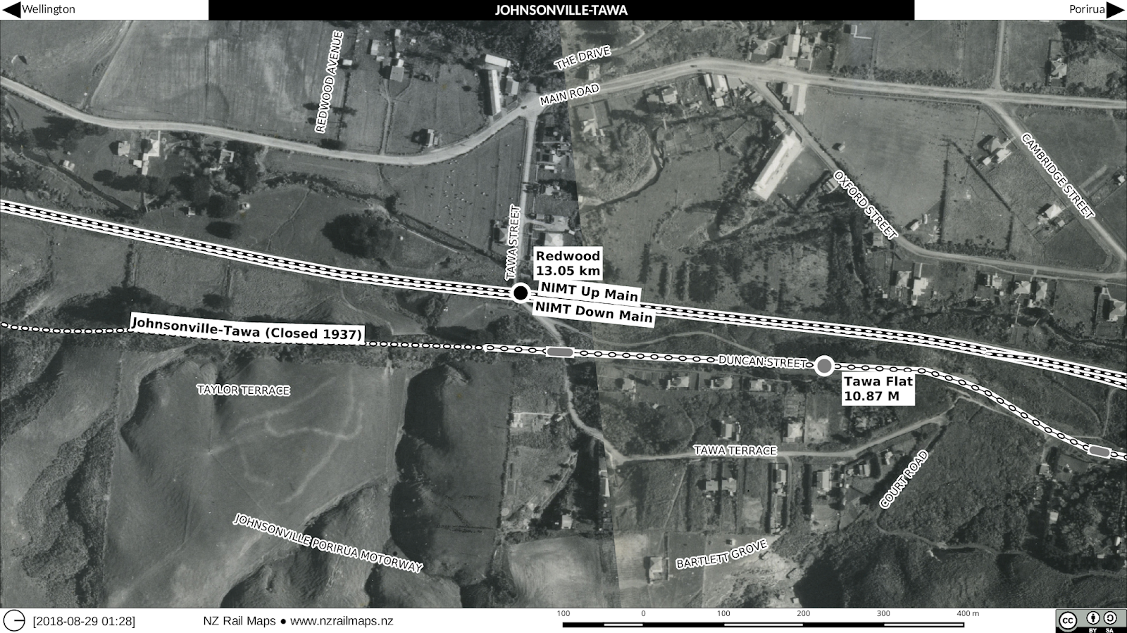
Here is the latest set of proofs for the Tawa Historical Society. I am still in discussion for their exact requirement for their book.