
Time for a quick update on progress with this. I had hoped to be further along with this process but the work needed on the big aerial image mosaics (there is one with 17 layers for the Johnsonville end and a similar or bigger one for the Tawa end) took a very long time to finish just for the Johnsonville one which has finally been completed, because with an 8 GB image when compressed, decompressing and processing these results in a much bigger memory footprint. Since the computer with 16 GB struggles to cope with these layers I am considering upgrading a computer to 32 GB but that will cost $500 so is not going to happen anytime soon. Fortunately there are not too many mosaics that are that large.
There are two main historical mosaic images so far as shown below and the commentary attached to each one from Nicol Campbell which he supplied to me in 2002 and which I have been scrutinising ever since. These images have had to be downsampled because servers keep refusing to upload them at their original sizes although Flickr has accepted larger size versions than I can get to upload to Facebook or even Google Photos.

The commentary for this part reads as follows:
"As most of us know the Johnsonville on-ramp to the motorway follows the original line of railway north from Johnsonville. The old formation crossed what is now the motorway at a small angle and entered a cutting on the north side some 500 metres from the where the on-ramp joins the motorway proper. This cutting is still obvious although now choked with scrub and is blocked completely after 50 metres or so by fill used for road construction when the Paparangi sub-division was being developed."
Key points therefore:
- One of those curves that crosses over the motorway is a cutting part of which still exists - or did so in 2002.

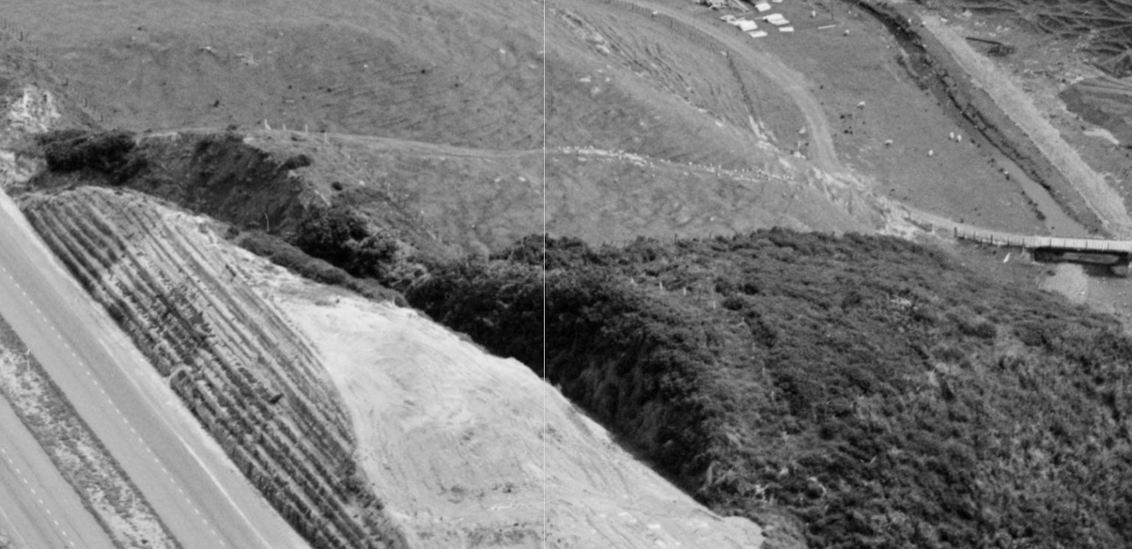
This part incorporating the Belmont Viaduct includes the following commentary:
"The next obvious sign of the old right-of way are the two concrete abutments where the Belmont Viaduct once stood. The northern abutment is still easily seen but the southern one, now in a backyard, is vine covered and needs a little study to discern its location. In the gully the old concrete footings and some rusted ironwork can be found if one wishes to fight through the undergrowth. The right-of-way north from here can be discerned heading in a shallow curve towards a hill that once had a cutting running through to the motorway and was obvious until a few years ago when it too was filled for more development. The line then cuts across the motorway at a sharp angle and continues along its west side but slightly below road level. It is not continually visible from the motorway but because of the heavy earthworks needed in the hilly country the line can be easily traced on foot as it slowly descends through a succession of cuts and fills."
Key points:
- Remains that can be found at the Belmont Viaduct site.
- The northern approach onto the viaduct is in public park and part of the abutment and cutting still exists.
- The line cuts across the motorway and on the far side there was a cutting part of which may still exist. Here is what this part looks like in Google Earth from the motorway.

Here is another photo of this area from when the motorway was first constructed:
So if one was to walk behind that hump there should be some cuttings in behind there.
- There may be other cuttings and fills still in existence along this stretch of the motorway.